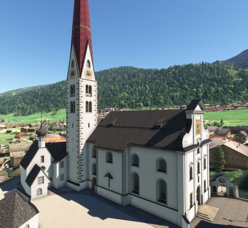
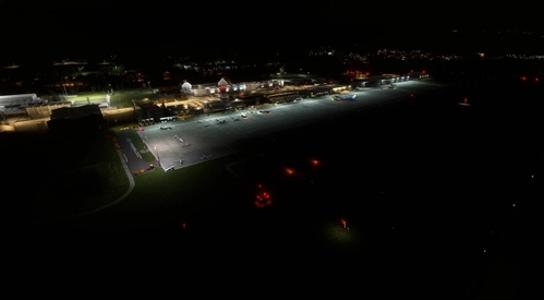
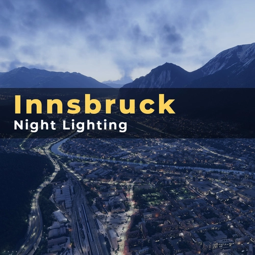
Flightsim.toFlightsim.to

    Szenerie in Austria

    94 Szenerie-Add-ons verfügbar

    94Ergebnisse
    Sortieren nach:
    Aktive Filter:Austria
    AUSTRIA 10m DEM - High Resolution Terrain Elevation Data from LIDAR Imaging

    AUSTRIA 10m DEM - High Resolution Terrain Elevation Data from LIDAR Imaging

    Explore the stunning terrain of Austria with this mod featuring high-resolution LIDAR data, offering a mesh resolution of 10m for a more realistic flight experience. Flatten lakes, rivers, and eliminate any terrain artifacts as you soar over the Austrian landscape. Divided into regions for convenience and performance optimization, this mod enhances the mountain shapes to mirror reality and provides a smoother flying experience. Experience Austria like never before with enhanced elevation data and realistic terrains.

    TroglodytusTroglodytus
    MSFS2020
    5.0(56)
    24.6K
    1.53 GB
    4 years ago
    Vienna Landmark Pack - v1.9

    Vienna Landmark Pack - v1.9

    Enhance your Vienna flying experience with over 50 landmarks including St. Stephens Cathedral and Schloss Schönbrunn. Explore key sites like UNO City and Vienna Riesenrad in this detailed city rendition. Stay updated on ongoing improvements for night lighting and 3D models. Download now for a better LOWW (Vienna International Airport) adventure!

    TroglodytusTroglodytus
    MSFS2020
    4.6(55)
    14.4K
    1.94 GB
    5 years ago
    Austrian Landmark Project (ALP)

    Austrian Landmark Project (ALP)

    The Austrian Landmark Project (ALP) is a collaborative effort by Littlekrg & Troglodytus to enhance the scenery of Austria in Microsoft Flight Simulator. This add-on includes UNESCO World Heritage Sites, churches, castles, towers, structures, a water runway, and more. Stay tuned for future updates with additional improvements and new landmarks. Installation is simple - just drag and drop the folder into your community folder and enjoy the enhanced Austrian scenery.

    TroglodytusTroglodytus
    MSFS2020
    5.0(34)
    13.2K
    1.44 GB
    1 year ago
    Innsbruck City / LOWI Approach, Austria (ORBX LOWI Compatible)

    Innsbruck City / LOWI Approach, Austria (ORBX LOWI Compatible)

    Experience Innsbruck city and LOWI Approach like never before with this add-on based on Google Maps photogrammetry. Compatible with ORBX LOWI Airport, this scenery brings stunning detail to your simulator. Simply download, unzip, and enjoy a realistic and immersive flight experience. Credits to Jonahex111, thalixte, and Google Maps for their contributions to this impressive add-on.

    ezroezro
    MSFS2020
    5.0(10)
    10.7K
    1.54 GB
    4 years ago
    Innsbruck Austria Scenery Photogrammetry

    Innsbruck Austria Scenery Photogrammetry

    Experience Innsbruck, Austria like never before with this photogrammetry scenery add-on. Perfect for the Innsbruck landing challenge, this mod includes 2 LODs and fixes on rivers and water bodies for a more immersive flight simulation. Simply extract the folder to your /Community/ folder and enjoy the enhanced visuals of this scenic cityscape.

    GobbyGobby
    MSFS2020
    4.8(12)
    10.0K
    814.92 MB
    5 years ago
    Mikea.at - Landmarks Vorarlberg

    Mikea.at - Landmarks Vorarlberg

    Discover a growing collection of landmarks in and around Vorarlberg, Austria with Mikea.ats Landmarks Vorarlberg add-on. Starting off with the iconic "Senderbrücke," this pack promises to expand over time, offering more immersive experiences for virtual pilots exploring the region.

    Mikea.atMikea.at
    MSFS2020
    4.8(8)
    6.6K
    371.92 MB
    2 years ago
    Salzburg, Austria - Photogrammetry

    Salzburg, Austria - Photogrammetry

    Explore the photogrammetry data of Salzburgs historic city center in this add-on package. Discover the Baroque architecture and UNESCO World Heritage Site with added points of interest for navigation. Fly from Salzburg International Airport (LOWS) and immerse yourself in the culture and history of Austrias inspiring city.

    TroglodytusTroglodytus
    MSFS2020
    4.8(21)
    6.5K
    1.55 GB
    5 years ago
    Airpower  Airshow for Microsoft Flight Simulator

    Airpower Airshow for Microsoft Flight Simulator

    Experience the largest airshow in Europe with "AIRPOWER for Microsoft Flight Simulator 2020." Join military and civil aviation demonstrations at Zeltweg Air Base, featuring realistic crowd depictions and 43 handcrafted aircraft on display. Dont miss out on this immersive airshow experience with static displays and dynamic elements!

    5.0(24)
    5.6K
    406.07 MB
    1 year ago
    AUSTRIA 20m DEM - High Resolution Terrain Elevation Data from LIDAR Imaging

    AUSTRIA 20m DEM - High Resolution Terrain Elevation Data from LIDAR Imaging

    Explore Austria with this high-resolution terrain elevation data add-on, featuring LIDAR imaging with a mesh resolution of 20m. Enjoy realistic mountain shapes and smooth lakes and rivers, while minimizing terrain artifacts. Ideal for lower spec PCs, offering a smoother flying experience compared to the 10m version. Please note potential compatibility issues with add-on sceneries.

    TroglodytusTroglodytus
    MSFS2020
    4.9(13)
    5.5K
    643.67 MB
    4 years ago
    Jetway Advertisement Correction for GayaSim LOWW

    Jetway Advertisement Correction for GayaSim LOWW

    This add-on modifies the jetways in the GayaSimulation LOWW scenery to reflect the current real-life design used at the airport, replacing them with VIG-branded textures. Due to limitations in the original Gaya scenery, the changes standardize the jetway appearance, although not all real-world advertisements can be replicated at this time. Installation involves copying texture files into the GayaSimulation LOWW folder within the Community Folder, with a backup of the original files strongly reco

    KBNOtakuKBNOtaku
    MSFS2020/24
    5.0(2)
    5.0K
    4.33 MB
    3 months ago
    [LOXZ] - Fliegerhorst Hinterstoisser - Aerial

    [LOXZ] - Fliegerhorst Hinterstoisser - Aerial

    Discover Fliegerhorst Hinterstoisser in Zeltweg, Austria with this addon offering 2 aerial/satellite images for download. Covering about 101 km² of high-definition aerial imagery for Murtal Valley, this addon complements the Zeltweg Airbase experience. Simply install by dragging the downloaded files into your community folder.

    5.0(6)
    3.9K
    2.02 GB
    3 years ago
    Showing 1 - 12 of 94 results