Beschreibung
Hello everyone,
This extension allows you to compile the photoreal zones of my airports/aerodromes created in the MSFS SAI331 zone. This will allow you to view all the zones because unfortunately the Microsoft SDK limits the number of scenes with the SAI331.bgl file in the scenery library. This extension allows you to bypass this limitation and is only valid for my scenes. It is intended to be upgradeable, so other zones will be added.All areas have been cleaned of static aircraft on the ground. The whole package is 100% compatible with the base Bing layer or Map Enhancement layers. It's a win-win situation.
At the moment the areas covered are :
- LFEA - Belle-Ile-en-Mer
- LFEQ - Quiberon
- LFFO - Fromentines
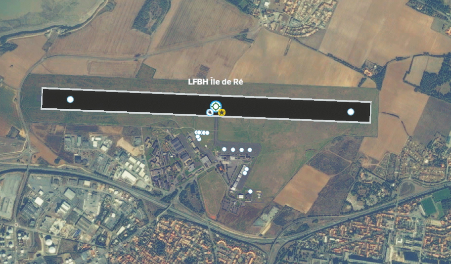
- LFBH - La Rochelle
- LFJI - Marennes
- LFRF - Granville
- LFCY - Royan
- LFOO - Les-Sables-D'Olonnes
- LFIY - Saint-Jean-D'Angély
- LFDP - Ile-D'Oléron
- LFRY - Atlantique-Air-Park
This package is required for optimum use of the above-mentioned stages.
Enjoy your flight!
Bonjour à tous,
Cette extension permet de compiler les zones photoreel de mes aéroports/aérodromes créer dans la zone MSFS SAI331. Cela vous permettra de visualiser l'ensemble des zones car malheureusement le SDK de Microsoft limite le nombre de scènes ayant le fichier SAI331.bgl dans la bibliothèque des décors. cette extension vous permet de passer outre cette limitation et n'est valable que pour mes scènes. Elle se veux évolutive donc d'autre zones vont venir le compléter. Toutes les zones ont été nettoyées des avions statiques au sol. L'ensemble est 100% compatible avec la couche Bing de base ou les couches de Map Enhencement. Tout le monde y gagne.
à l'heure actuelle les zones couvertes sont :
- LFEA - Belle-Ile-en-Mer
- LFEQ - Quiberon
- LFFO - Fromentines
- LFBH - La Rochelle
- LFJI - Marennes
- LFRF - Granville
- LFCY - Royan
- LFOO - Les-Sables-D'Olonnes
- LFIY - Saint-Jean-D'Angély
- LFDP - Ile-D'Oléron
- LFRY - Atlantique-Air-Park
Ce package est nécessaire pour l'utilisation optimale des scènes citées précédemment.
Bon vol !
Kommentare(1)
Melden Sie sich an, um an der Diskussion teilzunehmen
AnmeldenFrance-MaxGG60-Scenery-Photoreal-SAI331
The France-MaxGG60-Scenery-Photoreal-SAI331 add-on enhances the visual experience of several airports and aerodromes in the MSFS SAI331 zone by compiling photorealistic scenery. This extension addresses the limitations imposed by the Microsoft SDK regarding scene management, allowing users to access a broader range of detailed zones. Currently covered areas include several locations such as Belle-Ile-en-Mer, La Rochelle, and Granville, all of which are devoid of static ground aircraft for a more immersive environment. The package is fully compatible with the default Bing layer and map enhancement layers.

Unterstützer
Location
More Information
Versionsgeschichte
Keine Versionsgeschichte verfügbar.
Ähnliche Addons
Feather River Canyon (USA/CA)
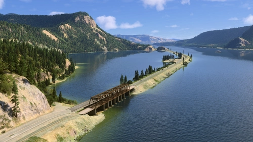
Enhance your Microsoft Flight Simulator experience with the Feather River Canyon add-on, offering a detailed scenery update along Californias Feather River. Spanning over 90 miles, this add-on improves visuals from Oroville Dam to Butt Valley Reservoir, featuring various natural and manmade structures such as boulders, dams, bridges, and railroad tunnels. Designed for low-level flying, it incorporates elements inspired by the California Zephyr railway and focuses on creating an immersive flying environment.
von Boulder
London Scenery Fix + London City Airport Water Fix
This add-on enhances the visual quality of London City Airport (EGLC) and the Thames River, providing an improved water texture and atmosphere. It aims to create a more realistic and immersive experience for pilots navigating the iconic London skyline and its waterfront areas. The mod is designed to elevate the scenery of the capitals docklands, enriching the overall flight simulation experience.
von MrAviatorPilot
Upper Sacramento River / Lake Shasta (USA/CA)
This add-on enhances the scenery of the Upper Sacramento River in California, from Dunsmuir to Box Canyon Dam. It addresses terrain inaccuracies, correcting the rivers elevation and water mask issues while introducing additional details like rocks, railroad bridges, and lighting near Dunsmuir Railroad yards. Compatibility with updated Bing maps is intended for improved visual fidelity.
von Boulder
Columbia River (USA/Washington)
This add-on modifies the Columbia River segment from Grand Coulee to Portland in Washington, USA, by enhancing the water masking and adding detailed river banks. It includes new points of interest with nameplates and bridges, alongside fixes for terraforming issues around dams, particularly addressing height inaccuracies at Grand Coulee Dam. Required object libraries are specified for full functionality.
von Boulder
almost 2 years ago
Dans l'attente de vous lire