Beschreibung
Western Sydney International (Nancy-Bird Walton) Airport (IATA: WSI, also known as Western Sydney Airport, Western Sydney International Airport, or Badgerys Creek Airport) is an international airport currently under construction in the suburbs of Luddenham and Badgerys Creek, New South Wales, Australia located 43 kilometres west of Sydney Kingsford Smith Airport. The first stage of construction on the new airport began on 24 September 2018.
The current objective of my project should be close to the first operation expected in October 2026. Some or most content of my project may not be official, complete, or accurate. Major features are as follows:
ICAO code: YSWS
Country: Australia
State: New South Wales
City: Badgerys Creek
Ground: 80 m or 262 feet above mean sea level
Runway 05-23
Magnetic Variance 12.66 degree at end of 2026
Glide Slope 3 degree
ILS IDs and frequencies (fictitious) are:
IXNW 110.500 MHz for 05
IXNE 110.300 MHz for 23
Fictitious waypoints at start of base legs:
WSINA for 23 at 5000 MSL
WSIWA for 05 at 6000 MSL
There are two fictitious SIDs and four fictitious STARs with Enroute Transitions.
Parking spots:
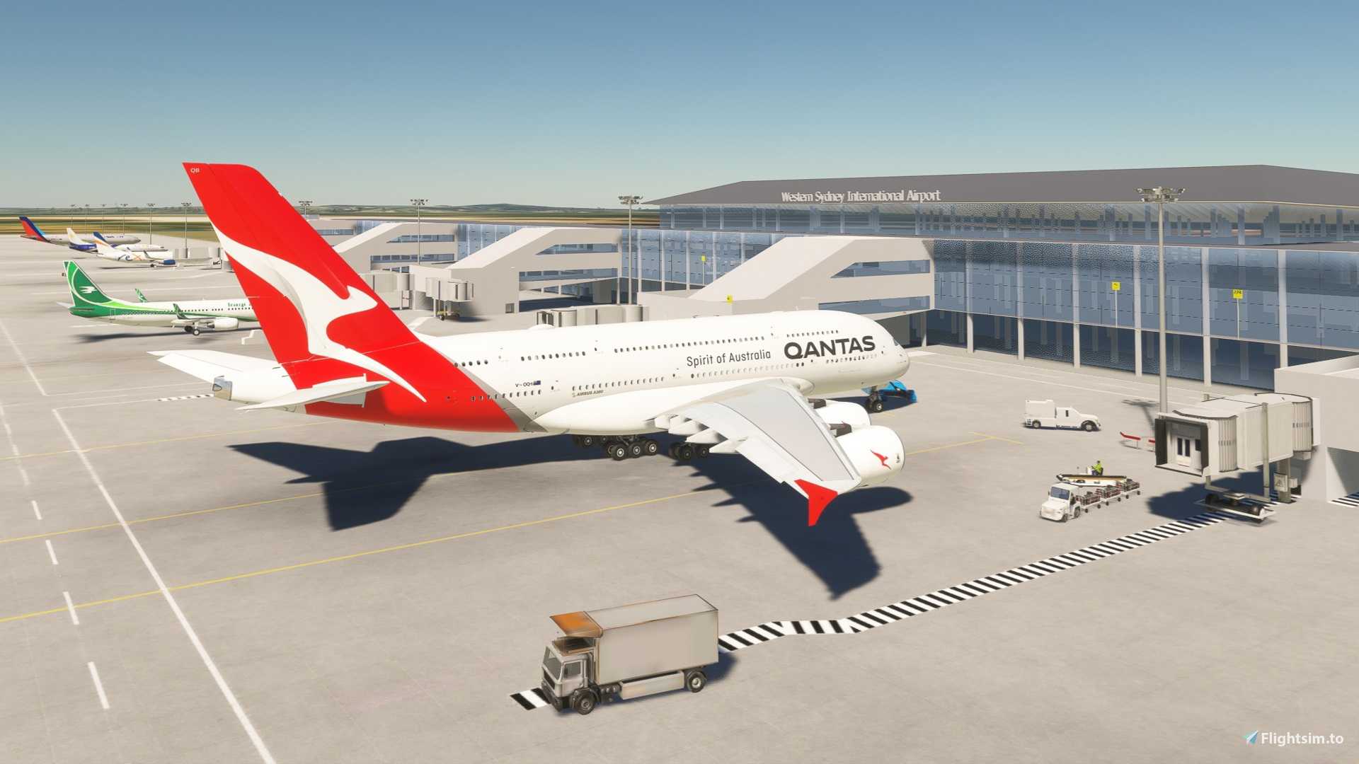
1) Ramps #91-99 for cargo
2) Ramps #14-18 and #26-30 for passengers without jetways
3) Gates #19-25 for passengers with jetways
4) Fuel #13F, #31F, and #99F for small propeller
Other features:
1) Communication frequencies (fictitious)
2) Passenger terminal building
3) Freight Centre
4) Explore yourself
Aircraft for my testing (e.g. missed approach, etc.) are:
1) B747-8i (Salty stable version 0.6.0)
2) A320neo (FBW stable version 0.14.0)
3) A380X (FBW stable 4K version 0.14.0)
4) Cessna 172 Skyhawk
Weather station is not simulated other than ATIS. Please visit the followings for further details:
http://www.bom.gov.au/products/IDN60801/IDN60801.94752.shtml
https://www.bom.gov.au/location/australia/new-south-wales/metropolitan/o117167555-badgerys-creek
Primary reference for orientation, dimensions and locations:
1) https://westernsydney.com.au/your-airport/airport-site-layout
2) Open Street Map
3) Google Map Satellite Images
4) Various YouTube videos of Western Sydney International Airport Updates
Häufig gestellte Fragen
Kommentare(20)
Melden Sie sich an, um an der Diskussion teilzunehmen
Anmelden6 months ago
7 months ago
7 months ago
7 months ago
8 months ago
7 months ago
over 1 year ago
over 1 year ago
over 1 year ago
good job
over 1 year ago
over 1 year ago
over 1 year ago
over 1 year ago
over 1 year ago
over 1 year ago
As 05R/18L won't be developed for some time maybe add the 'red cross' at each end to signify out of use (there probably is a way in Devmode to select this - can't remember).
Also do you intend to update your airport with the release of updated Google Earth satellite images and/or images of the airport building now that is almost complete?
If I get the time and the inclination, I will create Custom Aerial Imagery using satellite imagery to add the current ground 'texture', which changes often during construction, and let you know.
Did you know that the ILS is type CAT III-B (I haven't yet checked how you have it set up or in fact that it can be set up that way in MSFS).
over 1 year ago
over 2 years ago
YSWS Western Sydney International Airport
YSWS Western Sydney International Airport is a new international airport currently under construction in Badgerys Creek, Australia. Located approximately 44 kilometers west of Sydney, the airport is set to commence operations in late 2026. This add-on features detailed representations of the airports two parallel runways, fictitious communication frequencies, and various parking spots for cargo and passenger aircraft, aligning with published long-term plans. It also includes initial waypoints and procedural information for flight simulations within Microsoft Flight Simulator.

Location
More Information
Versionsgeschichte
Location and orientation of nearly all physical and logical items were modified in order to align with latest Open Street Map information. Bug fixing: • Left/right edges of taxiways should not be lighted. • Water ponds were removed
6 months ago