
Beschreibung
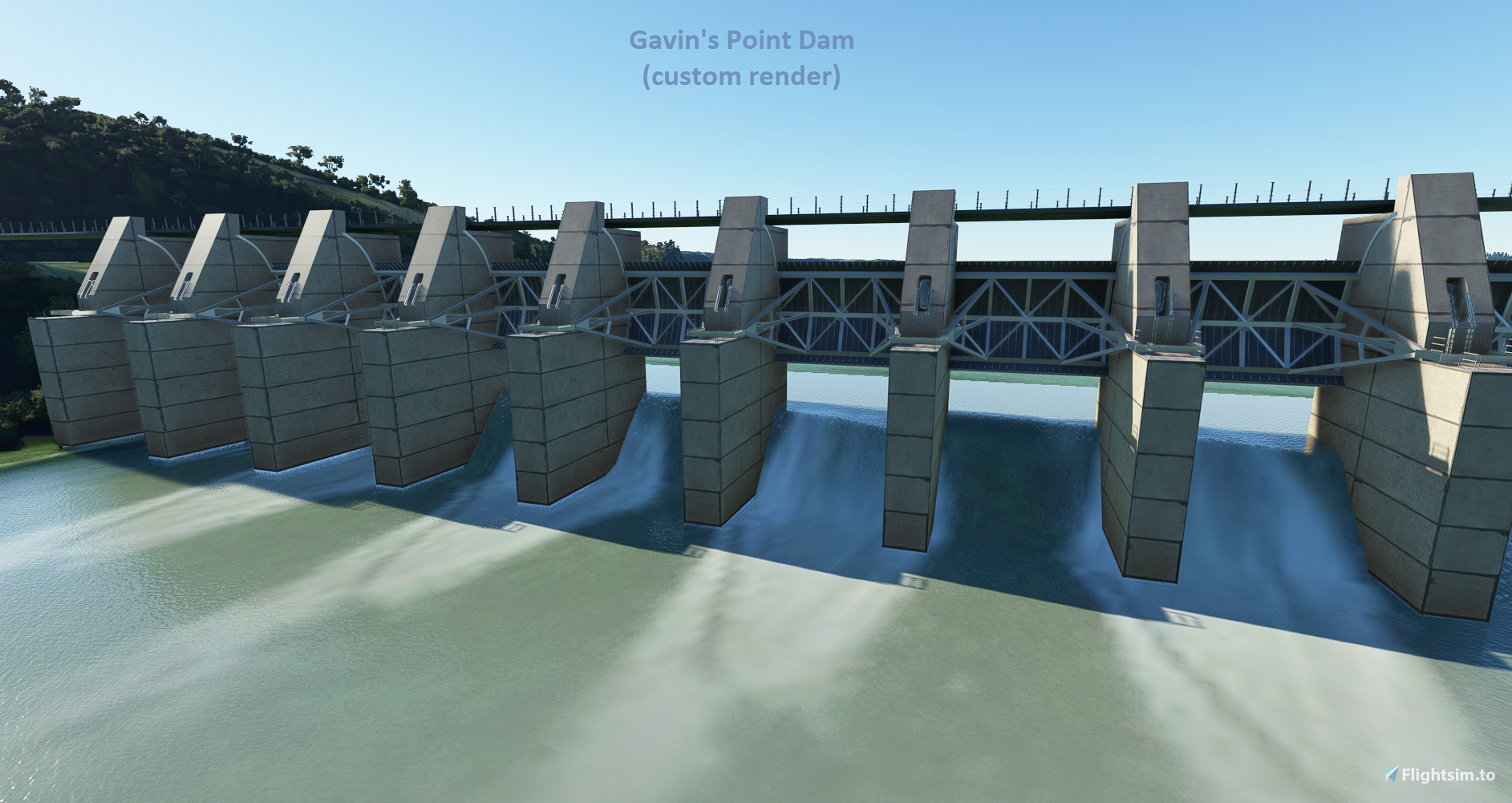
Elevation fixes, bridge improvements, and dam enhancements around the Missouri River. Coverage now goes North all the way to Gavins Point Dam on the Nebraska & South Dakota border, and south all the way to Kansas City. This should for the most part complete the fixes for the entire Missouri River. This update also fixes any spires in the area. A custom render of Gavin's Point Dam is provided from Blender (not photogrammetry). Note that to see the bridges you must have USA and Japan world content installed from the game's content manager.
New Version 1.50
(most significant update since 1.0)
- Expanded Coverage Area (Kansas to Nebraska to Iowa to South Dakota)
- Major Cities Include = Kansas City to Omaha to Sioux City to Yankton (Gavin's Dam)
- Improved coastline technique for better alignment of buildings and roads
- Further Improved the Gavin's Point Dam near Yankton
- Fixed tributaries and spire errors near Nebaska City Municipal (KAFK)
- Overall improved terrain and improved blending of river area
- Future Update Plans = Additional Custom Renders & POI's (TBA)
Version 1.4
- **Custom Render of Gavin's Dam Now Added**
- To find Gavin's Dam, fly out of Yankton (KYKN) and head SW about 5 miles
Version 1.0 to 1.3
- Extended coverage area all the way to South Dakota (and Sioux City, Iowa)
- Now properly preserved Mesh for Neale Woods (too flat+rigid in previous version)
- Added 5 bridges (requires USA + Japan Content)
- Note: absolute perfect river blending is not possible due to issue in the area
Alpha 0.2 Update - Resolved Issues
- Slight improvement in water blending
- Fixed certain buildings being excluded
Optional: Support this project with a donation to help ensure its success...
Kommentare(8)
Melden Sie sich an, um an der Diskussion teilzunehmen
Anmeldenover 5 years ago
over 5 years ago
over 5 years ago
over 5 years ago
over 5 years ago
over 5 years ago
over 5 years ago
Elevation Fixes for Missouri River (KS to NE to IA to SD) + Dam & Bridge Upgrades
Enhance your Missouri River flying experience with elevation fixes, bridge upgrades, and dam improvements. Covering areas from Kansas City to Gavins Point Dam on the Nebraska & South Dakota border, this update ensures a more realistic and complete scenery. Includes custom render of Gavins Point Dam and future plans for additional custom renders and POIs. Note: USA and Japan world content installation required for bridge visibility.
Downloads gestoppt
Der Ersteller hat die Downloads für dieses Addon vorübergehend gestoppt. Bitte versuche es später erneut.

Nutzerbewertungen
2 Bewertungen
Location
More Information
Versionsgeschichte
Expanded Coverage Area (Kansas to Nebraska to Iowa to South Dakota) Fixed Gavin's Dam Flashing Texture Coastline and Airport Fixes Mesh Fixes and Spire Removal for Nebraska City Municipal Area
Ähnliche Addons
KLGU - Logan Cache (Utah Airport)
KLGU - Logan-Cache Airport - Utah Airport with many custom renderings including custom rendered interior hangar, custom aircraft models and other renders including a helicopter, exotic car, custom train, street signs, renderings of the control towers, revamped aerial imagery, and more!
von AlpineScenery
Utah Enhanced (Early Access) + Bonus Airports
Enhances Utah and parts of Southern Idaho. Multiple custom airports are provided for both Utah and southern Idaho. Airports currently include Mantua Lake - UTML (fictional), Preston (u10), Burley Mun (KBYI), Bancroft (U51), Albion (39id), Oakley Mun (1u6), American Falls (U01), and more...
von AlpineScenery
over 5 years ago