
Beschreibung
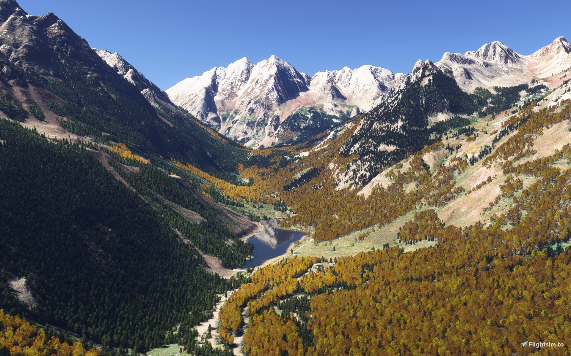
Colorado Seasons Enhanced & KGUC Gunnison-Crested Butte Regional restores fall colors where aspen and cottonwood trees had been misassigned as conifers/evergreens and features KGUC Gunnison-Crested Butte Regional among other mountain airports. This edition further refines areas where too many fall colors were added to some of these areas through recent MSFS photogrammetry and world updates, by removing some of the excessive distributions of aspens. It also removes the sharp, seasonal, straight lines of foliage at the photogrammetry quadrant's borders by "blending" the new photogrammetry foliage with redrawn, more natural transition areas on the four sides of the photogrammetry quadrant. This is also now a standalone upgrade, as it provides its own custom vegetation biome without the need of external vegetation enhancement packages. Everyone should now see the same fall colors that are represented in the pictures regardless of your setup. This scenery will also work side-by-side with Bijan Studio Seasons Enhanced 2024. The only difference will be that the timing of the seasonal changes will be more accurate. It also adds the following custom airports to this area:
(KGUC) Gunnison-Crested Butte Regional, Gunnison
(0CO2) Buckhorn Ranch (Crested Butte Airpark), Crested Butte
(CO1G) Marble Airstrip, Marble (airstrip added to the sim)
(39CO) Flying M Ranch, Montrose (previously closed - reopened for the sim)
***The best configuration to view seasonal foliage properly: leave the global photogrammetry on, but disable the "United States 3D Photogrammetry Cities" within World Update 22. Having "World Update 22 – United States 3D Photogrammetry Cities" enabled will break/disable the recently added base MSFS seasonal foliage in this region. Since my scenery sits above the "baked" photogrammetry, it will still appear. But if you want the base MSFS seasonal changes, which now "blend" well with mine, you will need to disable "United States 3D Photogrammetry Cities" by going to the MSFS Marketplace, My Library, search for Update 22, and disable United States 3D Photogrammetry Cities. (Please note that other photogrammetry areas rely on it and will also be disabled.) This will also restore the correct (original) satellite image at KGUC, getting rid of the mismatched photogrammetry satellite image border (introduced in World Update 22) that runs north and south through Crested Butte Mountain and the Gunnison airport.
v1.2 The valley connecting Maroon Bells to Aspen now has continuous fall foliage, and Kebler Pass now has continuous coverage extending to both Crested Butte and Marble.
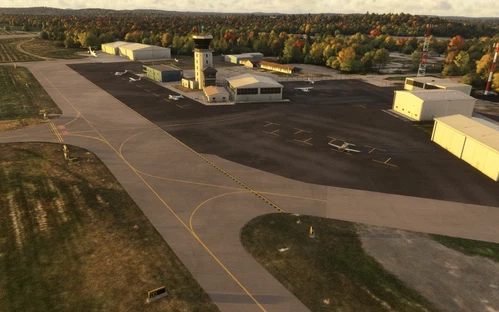
(KGUC) Gunnison-Crested Butte Regional: There is a visual (and functional) upgrade to KGUC which updates all the ground markings and cleans up some aprons but returns the underlying runway 07/25 to the designation of 06/24 until the FAA updates the Navigraph charts to match the newly painted 07/25 markings. I've "repainted" all the apron markings and updated taxiways to 07/25 as well. ATC communications will now reference 07/25 as 06/24. The FAA is "expected" to update the charts to reference runway 07/25 after 12/31/2026. When/if they do, I will release another patch to match. The ATC threshold/taxiway bug was resolved, and aircraft now taxi to the last taxiway, rather than the closest one to the threshold, when entering runway 25.
This edition starts in Southwestern Colorado and includes the Kebler Pass grove, with nearly 50 square miles of continuous coverage from Marble down to Gunnison, along with "feature" areas like Aspen/Snowmass, the Maroon Bells, Black Canyon of the Gunnison, Chimney Rock & Courthouse Mountain, Monarch Pass, Ohio Pass, Silver Jack Reservoir, and Telluride. Bridal Veil Falls (Colorado's highest free-falling waterfall) and Ingram Falls (a smaller waterfall above it) were also added on Black Bear Pass, above Telluride. The Kebler Pass aspen grove in the West Elk Mountains near Crested Butte, Colorado, is one of the largest clonal organisms in the world with roughly 47,000 genetically identical trees connected by a single, shared subterranean root system. This massive organism covers nearly 30 miles (specifically 31 miles along the pass) and offers one of the most significant fall color displays in North America, usually peaking from late September to early October, turning a vibrant gold in unison during fall, often challenging Utah’s similar Pando clone for the title of the world's largest living organism.
Due to the sheer number of complex polygons that need to be drawn to even begin to replicate natural tree lines where fall colors appear, this is (and will probably continue to be) a work in progress that will be updated, expanded, and refined over time. This scenery uses a tree type that doubles for both the missing aspens and cottonwoods typically found in Colorado, adding back the correct fall colors where these tree types had been misassigned as conifers/evergreens. As a result, these trees will now provide a contrasting "green" color to the pine trees in the spring and turn color and lose their leaves in the fall, creating much more realistic views in every season. Using this addon with the Bijan Studio Seasons Enhanced 2024 will allow for more correct timing of the seasonal color changes but is no longer required to see the correct trees. An effort has also been made to replace as many of the reds and oranges with yellows/gold in the towns associated with these areas for added realism.
Please note that when fall colors are at full peak, there are some locations where "hard" borders are more visible at the aspen/evergreen tree lines. Although these are drawn as accurately as the satellite imagery will allow, MSFS emphasizes these borders, because unlike in the real world where the color changes are more randomized, the seasonal change is more uniform in the simulator.
Upgraded airports remove/replace the default runway profiles and terraforming with new elevation data that restores the underlying terrain of airports, bringing back the real-world detail including everything from small drainage ditches to larger details like restored surrounding mountain terrains. Built with the SDK, MSFS library objects are assembled in a way to "look" like custom terminal buildings and more closely resemble their real-world counterparts, while not affecting framerates. Airport lighting, fencing, taxiway signs, markings, and network layouts are updated based on most recent satellite imagery, YouTube videos, and/or first-hand knowledge of the location. KGUC's runways 06/24 are now "painted" 07/25 (changed Fall of 2025) but are referenced as 06/24 in NOTAMS.
- Gunnison-Crested Butte Regional (KGUC) is served by United year-round and by American and JSX seasonally. Windy Things is required to see US and Colorado flags at KGUC.
- Buckhorn Ranch/Crested Butte Airpark (0CO2) in Crested Butte, Colorado, is part of the Buckhorn Ranch Subdivision. The Avion Club is a private fly-in/fly-out community at Buckhorn Ranch.
- Marble Airstrip (CO1G) in Marble, Colorado, is a private airstrip that requires prior permission from the owners, a signed liability waiver, and expert mountain flying skills. The 4,600-foot strip is nestled in a canyon, often used for camping and the annual Colorado Pilots Association fly-in.
- Flying M Ranch (39CO) near Montrose, Colorado, was a private airstrip that is reopened with this update.
Because AI aircraft behavior at non-towered airports is notoriously inconsistent (even with some external AI traffic injectors), a tower frequency (from the original Unicom) was added to KGUC to handle commercial traffic. This airport should now function and communicate properly with ATC. Beacons may sometimes appear higher than the actual beacon model when you begin (rather than complete) a flight at that airport. This is an inconsistent (and known) issue that occurs in the simulator and is not generated by the scenery itself. Runway "distance remaining" signs have yellow numbers instead of white, because the current SDK does not allow for white on a black background.
Points of Interest "Landmark Marker" icons that are not near a corresponding airport have been added to the map to make locations easier to find, or the provided coordinates can just be copied/pasted into the departure window, which will automatically be converted in the search results and take you directly to the following featured locations:
Aspen/Snowmass (accessed from airport KASE)
Black Canyon of the Gunnison (38.445670591 -107.448795445 - also accessed from 39CO)
Chimney Rock & Courthouse Mountain (38.141699896 -107.571851078)
Crested Butte (accessed from airstrip 0CO2)
Gunnison Valley (accessed from airport KGUC)
Kebler Pass (38.849850671 -107.100263971)
Marble (accessed from airstrip CO1G)
Maroon Bells (39.070891795 -106.988638455)
Monarch Pass (38.496796072 -106.326243994 - various locations between Salida and Gunnison along highway 50)
Ohio Pass Lookout (38.823288330 -107.079600626)
Silver Jack Reservoir (38.223715717 -107.539356014)
Telluride (accessed from airport KTEX)
Tools used to create this scenery:
MSFS 2024 SDK
MSFS 2024 Map Enhancement (to provide different satellite backgrounds to find aspens/cottonwoods)
Windy Things (for the US and Colorado flags)
Google Earth (both satellite and street view)
YouTube
First-hand knowledge of many of these areas
Abhängigkeiten
Location
Colorado Seasons Enhanced & KGUC Gunnison-Crested Butte Regional
Colorado Seasons Enhanced corrects tree assignments to bring realistic aspen and cottonwood fall colors to Southwestern Colorado in Microsoft Flight Simulator, covering around 50 square miles. The add-on upgrades scenery for notable areas such as Kebler Pass, Maroon Bells, Telluride, and several custom airports, including Gunnison-Crested Butte Regional. Airports feature improved terrain, accurate markings, and updated terminal structures. Points of interest and seasonal foliage changes reflect the region’s unique landscapes, with recommended compatibility for enhanced season mods.

Versionsgeschichte
This edition further refines areas where too many fall colors were added to some of these areas through recent MSFS photogrammetry and world updates, by removing some of the excessive distributions of aspens. It also removes the sharp, seasonal, straight lines of foliage at the photogrammetry quadrant's borders by "blending" the new photogrammetry foliage with redrawn, more natural transition areas on the four sides of the photogrammetry quadrant. This is also now a standalone upgrade, as it provides its own custom vegetation biome without the need of external vegetation enhancement packages. Everyone should now see the same fall colors that are represented in the pictures regardless of your setup. This scenery will also work side-by-side with Bijan Studio Seasons Enhanced 2024. The only difference will be that the timing of the seasonal changes will be more accurate. The valley connecting Maroon Bells to Aspen now has continuous fall foliage, and Kebler Pass now has continuous coverage extending to both Crested Butte and Marble. KGUC: There is a visual (and functional) upgrade to KGUC which updates all the ground markings and cleans up some aprons but returns the underlying runway 07/25 to the designation of 06/24 until the FAA updates the Navigraph charts to match the newly painted 07/25 markings. I've "repainted" all the apron markings and updated taxiways to 07/25 as well. ATC communications will now reference 07/25 as 06/24. The FAA is "expected" to update the charts to reference runway 07/25 after 12/31/2026. When/if they do, I will release another patch to match. The ATC threshold/taxiway bug was resolved, and aircraft now taxi to the last taxiway, rather than the closest one to the threshold, when entering runway 25.
Ähnliche Addons

KMTJ Montrose Regional (Colorado)
This add-on enhances Montrose Regional Airport KMTJ in Colorado, including updated terminal buildings, accurate runway profiles, and restored terrain detail using new elevation data. The package also features improvements for Clifford Field 1CO4 in Olathe and North Fork Valley Airport 7V2 in Paonia, reflecting their real-world layouts. Airport signage, lighting, and taxiway markings are brought up to date based on recent sources. Compatibility is maintained with seasonal scenery add-ons for a consistent regional experience.
von csharpe
KBRO Brownsville/South Padre Island (Texas)
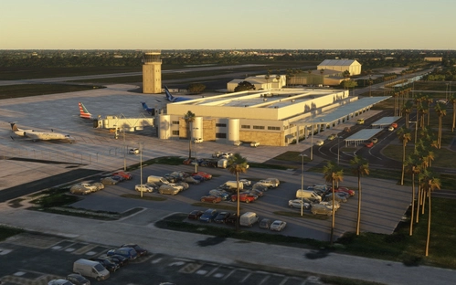
This add-on recreates Brownsville/South Padre Island International Airport in Texas with enhanced runway profiles, updated elevation data, and accurate terminal layouts. Utilizing default MSFS library objects, it closely represents the real-world airport while maintaining performance. The scenery reflects the latest taxiway signs, ground markings, and airport lighting based on up-to-date satellite imagery and local knowledge. The package also addresses typical SDK-related limitations in beacon placement and runway signage.
von csharpe
KLRD Laredo International Airport (Texas)
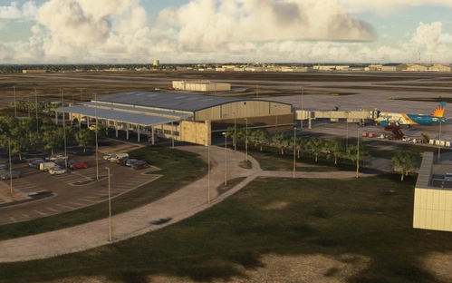
This add-on accurately represents Laredo International Airport in Texas, updating the layout, taxiway system, and facilities to reflect recent changes. The airport is a key commercial and cargo hub near the US-Mexico border, with services from multiple passenger and cargo airlines. Terminal buildings and hangars are modeled using MSFS library objects for optimized performance. Lighting, signage, markings, and structures are updated based on current imagery and sources.
von csharpe
KBVY Beverly Regional (Massachusetts)
This add-on recreates Beverly Regional Airport in Massachusetts, serving as a reliever airport for Logan International. Terminal buildings and facilities are modeled using MSFS library objects to closely match real-world structures while ensuring optimal performance. The airport layout, lighting, fencing, taxiway signs, and markings have been updated using recent imagery. Known MSFS-related issues with beacon elevations may occur but do not affect overall scenery quality.
von csharpe
Melden Sie sich an, um an der Diskussion teilzunehmen
AnmeldenKommentare14
A patch is coming soon once I repair a little more of the aftermath of an MSFS photogrammetry summer update that indiscriminately spread aspens all over the area as part of the National Parks Update... Apparently, it's feast or famine with those guys, when it comes to fall colors. ;)