Beschreibung
CURRENT UPDATE INFORMATION
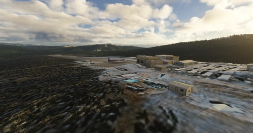
1/1/2021 1.2: Fixes conflict with new default terrain around Kantishna Airport and removes some redundant fixes
PREVIOUS UPDATE INFORMATION
9/2/2020 1.0:Updated more areas in Wrangell-St. Elias and around Anchorage.8/26/2020 0.9:Now Includes Wrangell-St. Elias National Park and Glacier National Park. Glacier National was surprisingly issue free for the most part.
Kommentare(27)
Melden Sie sich an, um an der Diskussion teilzunehmen
Anmeldenalmost 4 years ago
Is this going to be updated or even necessary?
about 4 years ago
Just curious if this mod is still needed or have Asobo updates rendered it unnecessary?
almost 5 years ago
Can people double check that this is still needed ?? with SU5 loks like verything is fixed in the Alaska and Chorage area.
about 5 years ago
Also around nova scotia the leveling is crazy.
over 5 years ago
over 5 years ago
But i do have one question and i'm wondering if you can help me? Can you tell me how to make similar changes on other locations? Say, I have a issue with a Lake in Australia where the water is too low. What would i be looking for / what tools should i be using to fix the lake i have here?
Basically, Can i get some basic instructions on how to fix water height in other places? Thanks!
over 5 years ago
Have you been facing issues when fixing water elevation issues against cliffs (basically, places where the river looks like a bobsleigh lane due to the engine not recognizing cliffs/canyons)?
I tried to fix this kind of issue by terraforming the river with a very low setting for the extent of the polygon (10 or so).
And it works well when the camera remains quite close but terrible when seen from afar - the cliffs newly created seem to be “dancing” with big variations in height at several points.
Thanks a lot for your help
over 5 years ago
over 5 years ago
over 5 years ago
over 5 years ago
over 5 years ago
Also thanks for your work on the Cub and the Grravel! My last few weeks on flightsim have pretty much only been bush flying using them :)
over 5 years ago
over 5 years ago
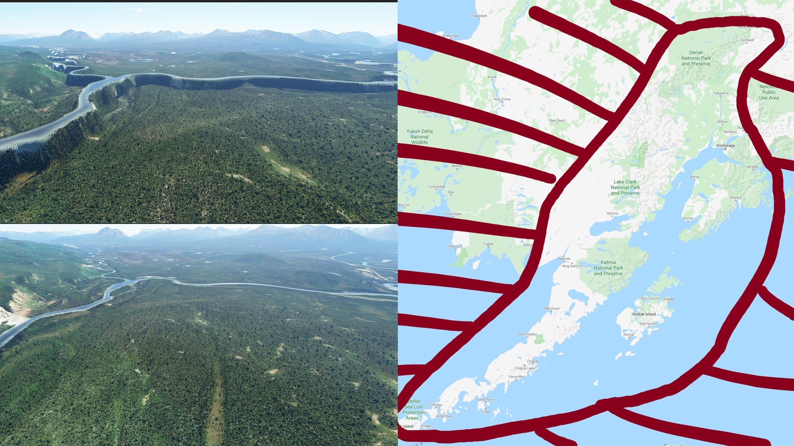
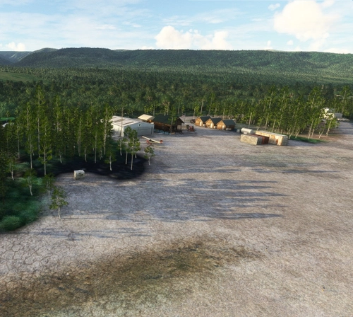
Alaska water height fix-Anchorage and Southern National Parks
Fix water height issues around Anchorage and Southern National Parks like Denali and Glacier National Park with this addon. Covers 400+ bodies of water, with recent updates including fixes for Kantishna Airport and improved terrain.

Unterstützer
Nutzerbewertungen
8 Bewertungen
More Information
Versionsgeschichte
Fixes conflict with new default terrain around Kantishna Airport and removes some redundant fixes
In Sammlungen enthalten(1)
Ähnliche Addons

Swiss mountains tree fix (trees on mountains removed)
A comprehensive mod fixing tree placement on Swiss mountains, particularly removing inaccurately placed trees on mountain peaks. The update includes a shift to more realistic conifer trees in the Alps and an expansion to border areas of France, Italy, and Austria. From Alpstein Säntis to Stockhorn, numerous locations across Switzerland have been meticulously corrected for a more authentic flight experience.
von THEOLI4D

Shorter Trees / Tree Height Modification VERSION 4.0 for MFS2020 (shorter, realistic trees)
Experience realistic and shorter trees in Microsoft Flight Simulator with the Shorter Trees / Tree Height Modification VERSION 4.0 add-on. Compatible with the latest version of MSFS, this mod provides adjusted tree heights for a more authentic flying experience. Update includes enhanced tree coloration blending seamlessly with photogrammetry trees. Installation is simple - just copy the folder into your community folder and enjoy a new perspective from the skies.
von ARIF STUDIOS - Adnan Arif

AUSTRIA 10m DEM - High Resolution Terrain Elevation Data from LIDAR Imaging
Explore the stunning terrain of Austria with this mod featuring high-resolution LIDAR data, offering a mesh resolution of 10m for a more realistic flight experience. Flatten lakes, rivers, and eliminate any terrain artifacts as you soar over the Austrian landscape. Divided into regions for convenience and performance optimization, this mod enhances the mountain shapes to mirror reality and provides a smoother flying experience. Experience Austria like never before with enhanced elevation data and realistic terrains.
von Troglodytus

SWITZERLAND 20m DEM - High Resolution Terrain Elevation Data from LIDAR Imaging
Explore the beauty of Switzerland with this mod offering high resolution terrain elevation data using LIDAR imaging. The mesh resolution is 20m, providing exceptional detail with a height resolution of 0.1m. Update includes extreme LIDAR meshes for specific regions. Please note potential performance impacts and report any bugs for further improvements. Fly VFR over Switzerland with enhanced realism and accuracy.
von Troglodytus
almost 3 years ago