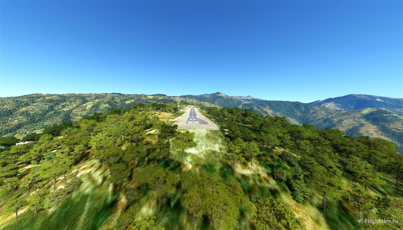
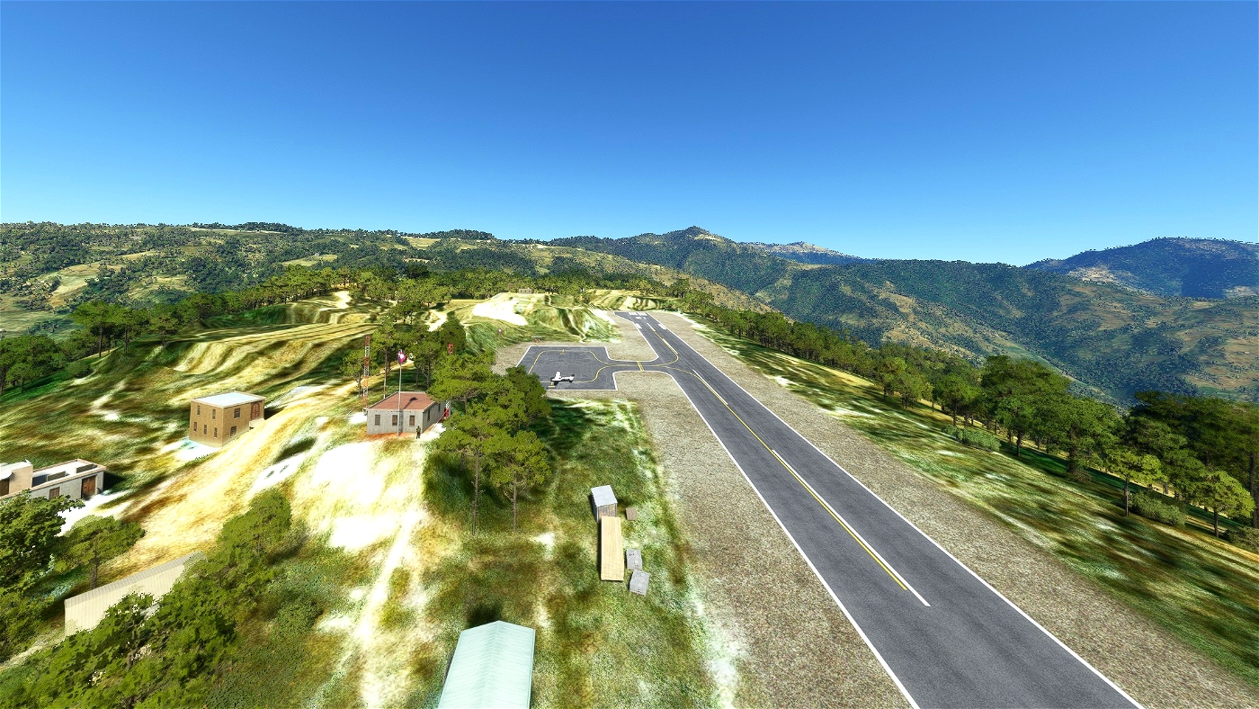
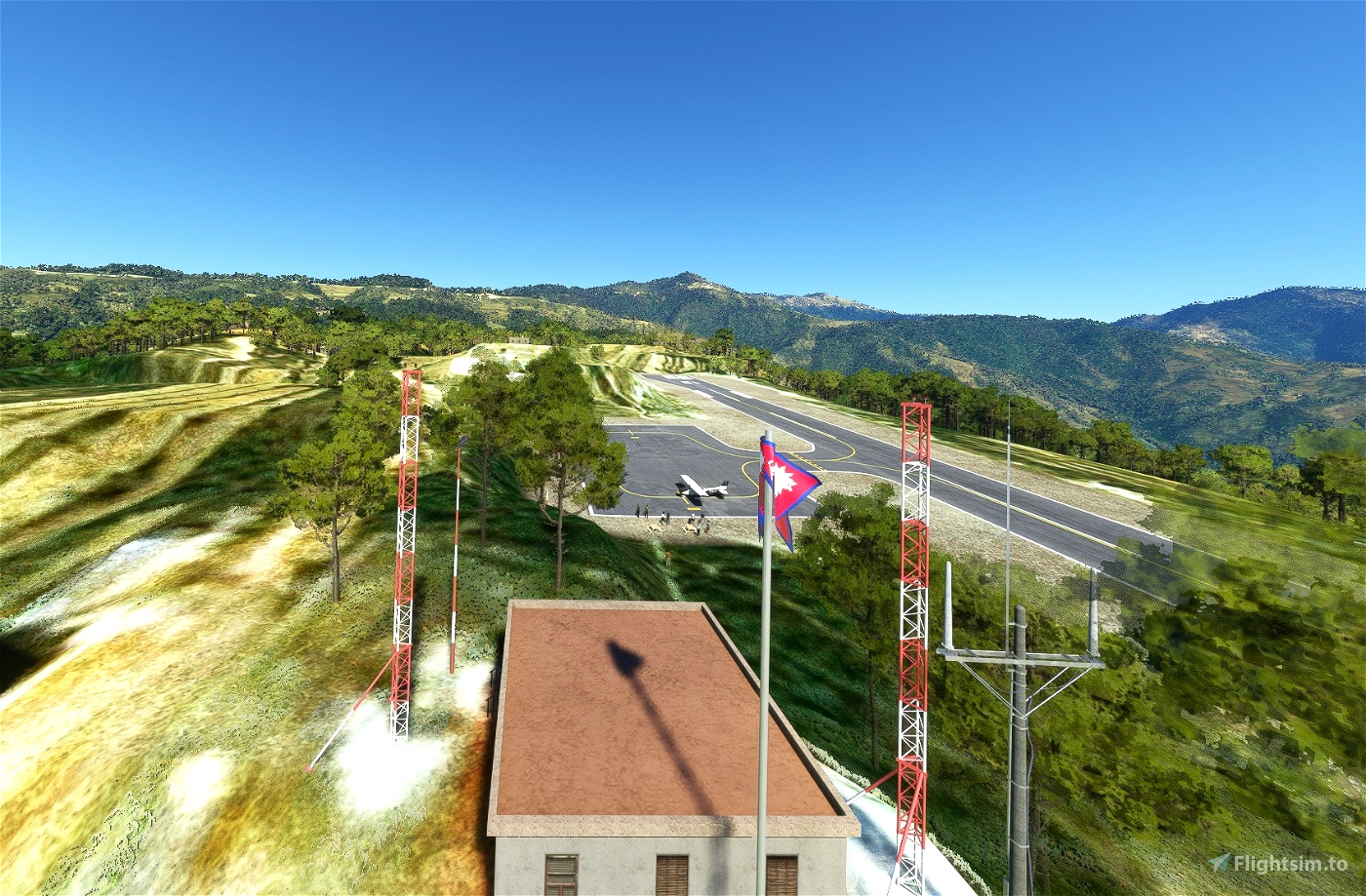
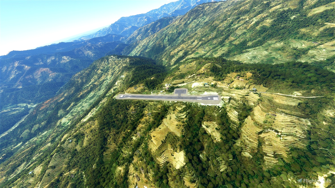
Thamkharka Airport (ICAO: VNTH) is a domestic airport located in Khotehang serving Khotang District, a district in Province No. 1 in Nepal
Airport type Public
Elevation amsl : 5.238 ft / 579 m
Owner : Government of Nepal
Operator : Civil Aviation Authority of Nepal
Coordinates 27.0482° or 27° 2' 53.4" north 86.8577° or 86° 51' 27.8" east
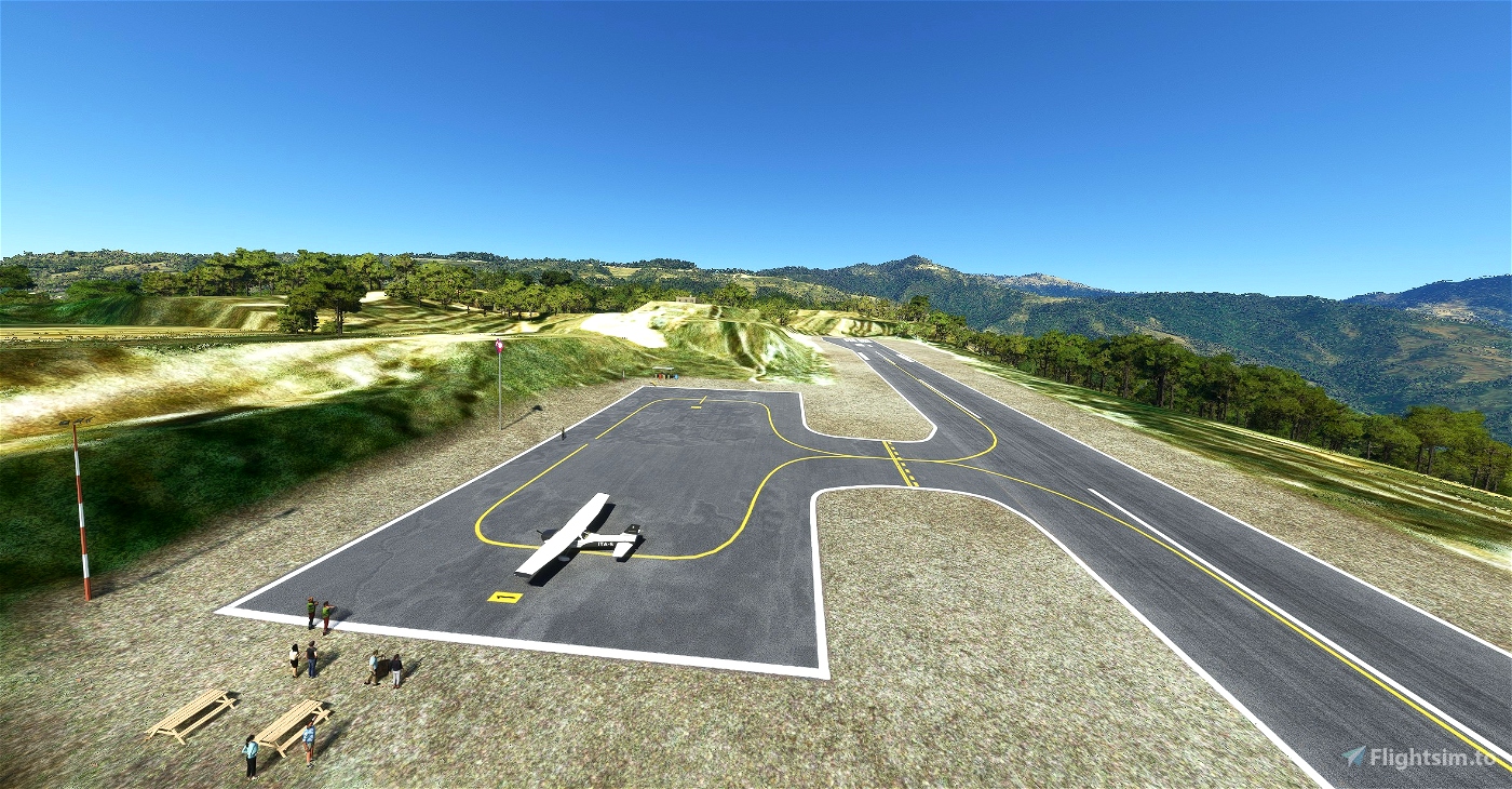
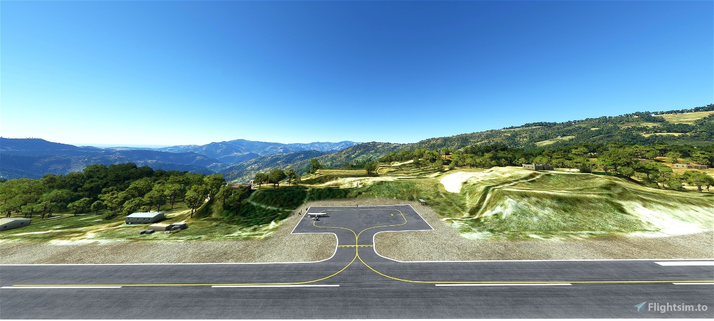
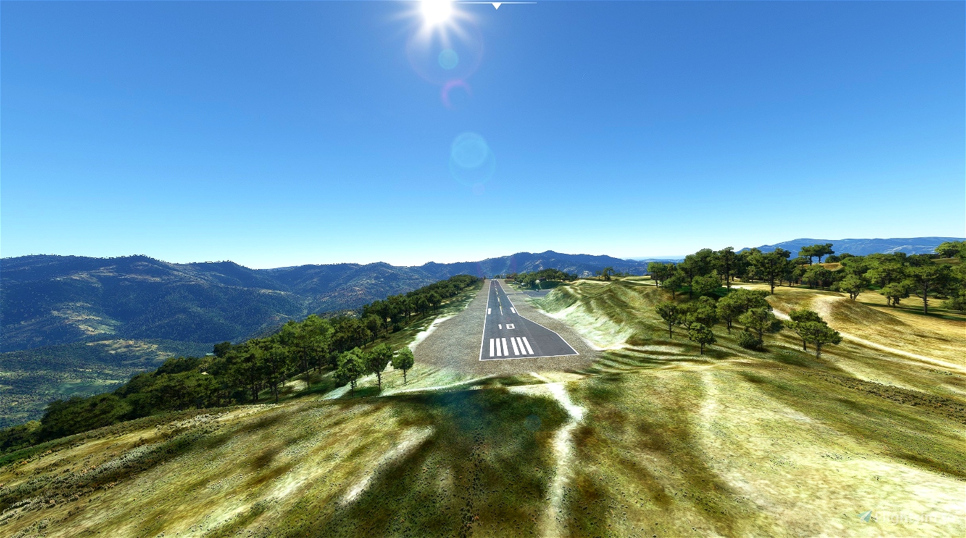
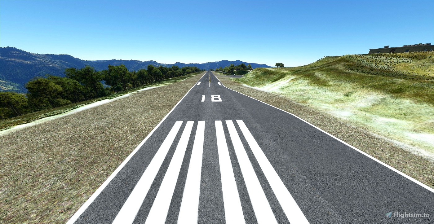
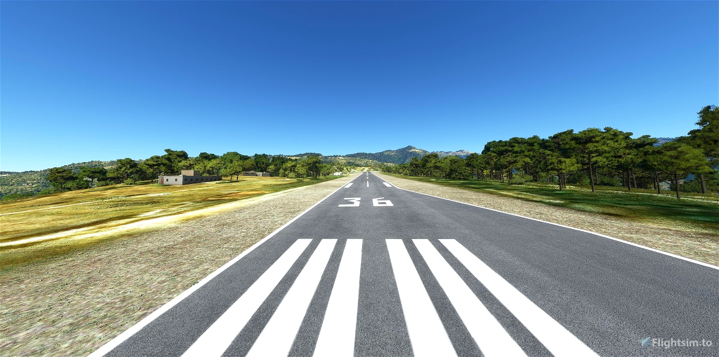
Runways Direction 18/36
Runways Dimension 630 m x 20 m / 2.067 ft x 66 ft
Service : AFIS / Visual Flight Rules (VFR)
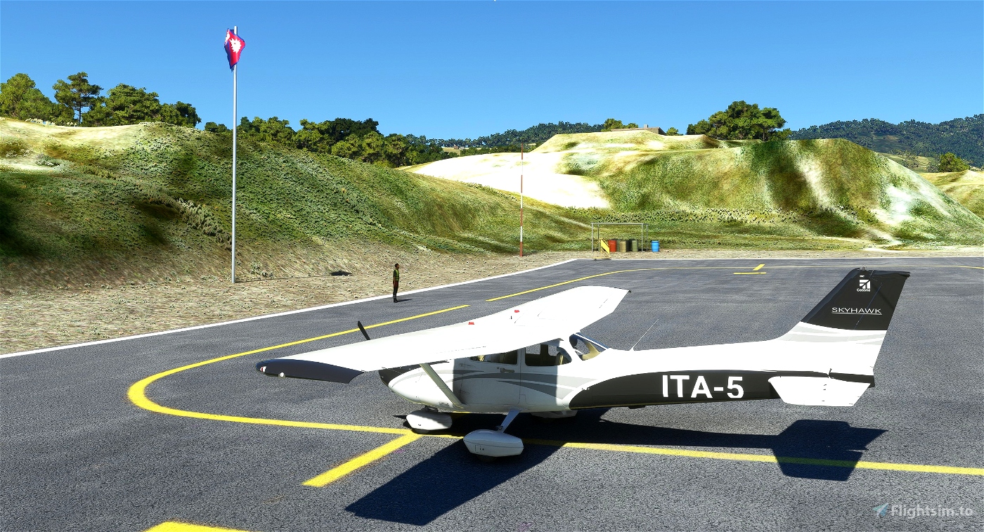
Type of Aircraft : DHC6, L410, Y12, C208
The Mod must be unzipped and introduced in the Community folder
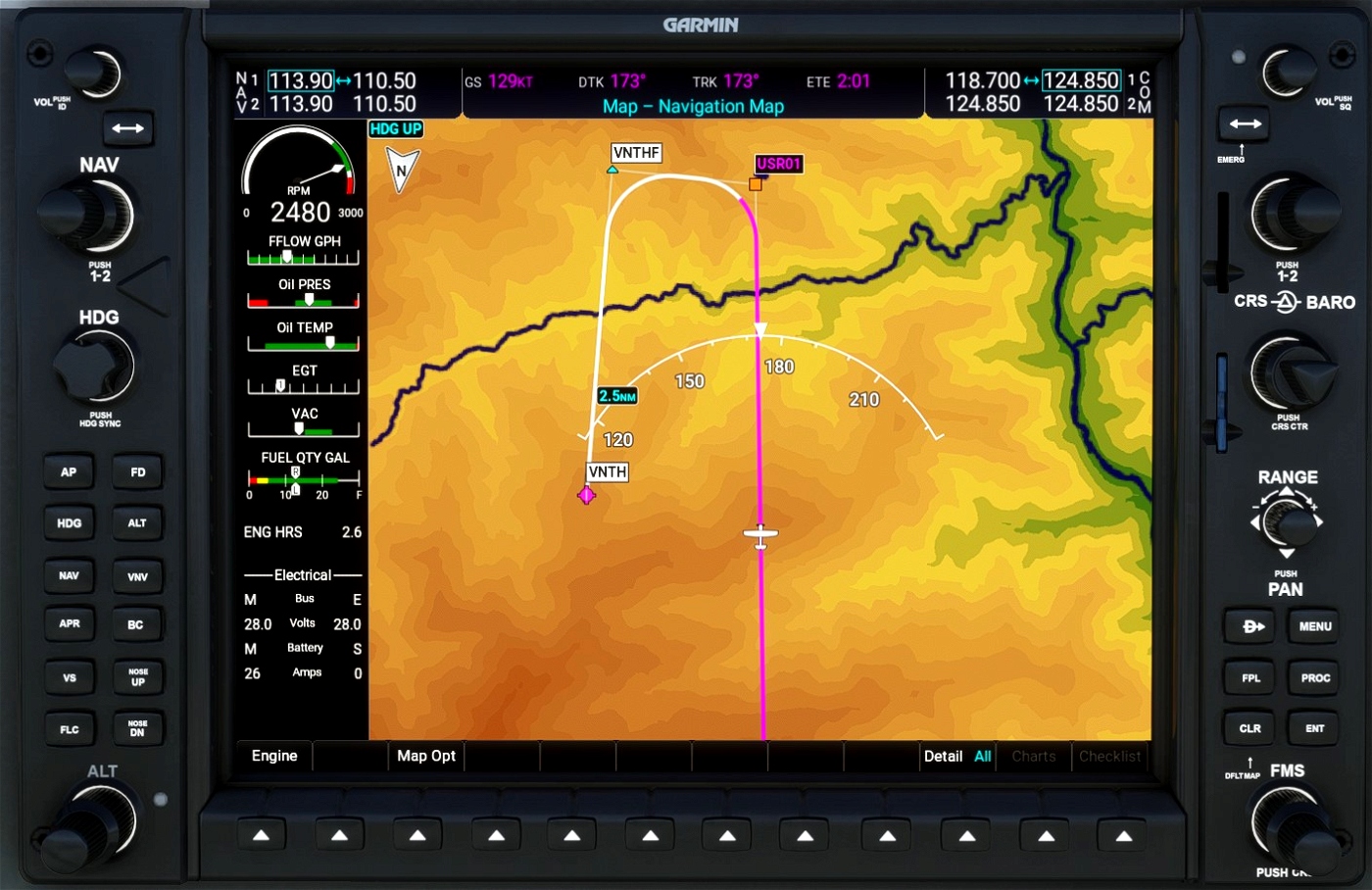
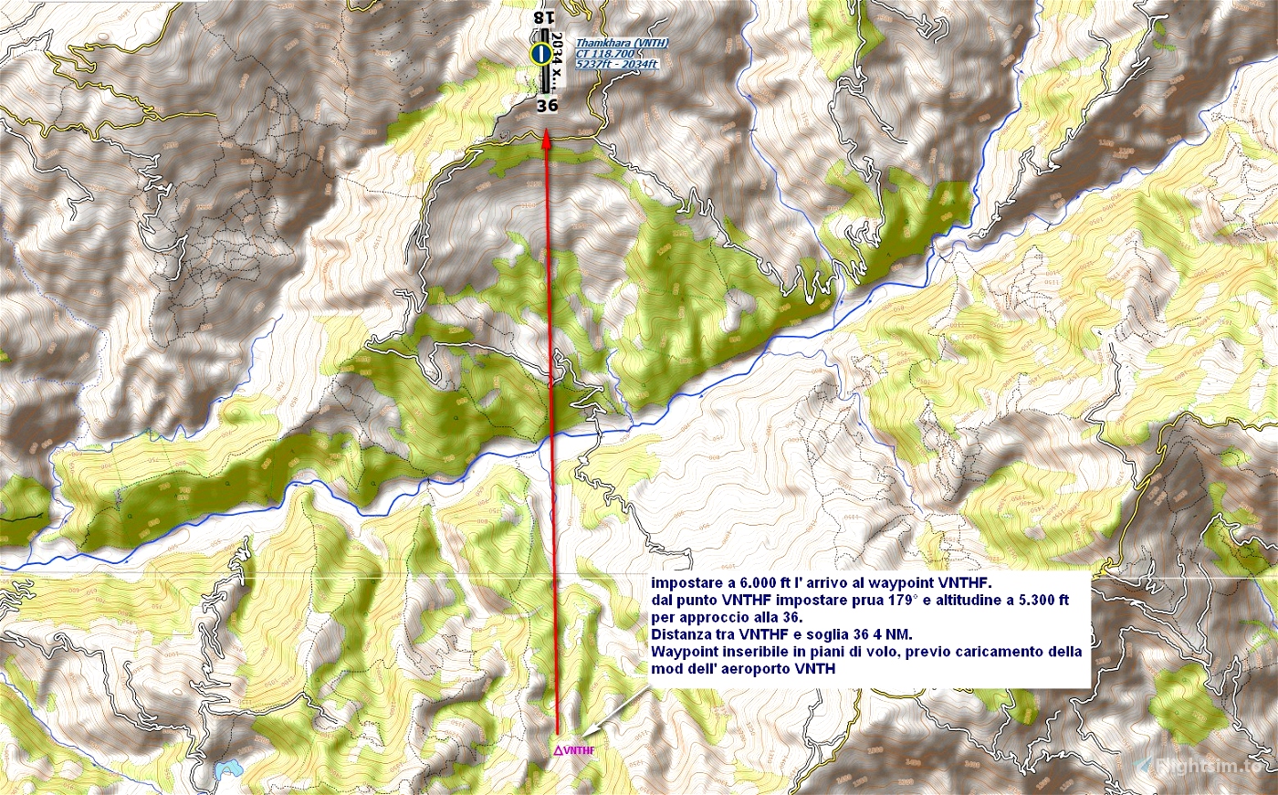
There is the VNTHF Waypoint, created for the occasion and not existing in the aeronautical charts, south of Runway 36 at 4NM, for reference to the approach of Runway 36.
Fly over this Waypoint at 6,000 ft with bow at 179 ° and set the altitude at 5,300 ft for the approach to Runway 36.
L'aeroporto di Thamkharka (ICAO: VNTH) è un aeroporto nazionale situato a Khotehang che serve il distretto di Khotang, un distretto della provincia n. 1 del Nepal.
Tipo Aeroporto: Pubblico
Elevazione AMSL: 5.238 ft / 579 m
Proprietario: Governo del Nepal
Operatore: Civil Aviation Authority of Nepal
Coordinate: 27.0482° or 27° 2' 53.4" nord 86.8577° or 86° 51' 27.8" est
Direzione Runways : 18/36
Dimensioni Runways : 630 m x 20 m / 2.067 ft x 66 ft
Servizi: : AFIS / Visual Flight Rules (VFR)
Tipologia di Aeromobili: DHC6, L410, Y12, C208
La Mod deve essere zippata e introdotta nella cartella Community
E’ presente il Waypoint VNTHF, creato per l’ occasione e non esistente nelle carte aeronautiche, a sud della Runway 36 a 4NM, per riferimento all’ approach della Runway 36.
Sorvolare questo Waypoint a 6.000 ft con prua a 179° e impostare a 5.300 ft l’ altitudine per l’ approccio alla Runway 36.


2 months ago
TommyvercettyGT
Unfortunately non compatible with Orbx Himalayas mesh
1 years ago
domkle
Hi Giampa_PoL, thanks for creating this addon in Nepal!
2 years ago
bstikkel
Grande lavoro, complimenti, sempre impeccabili le tue mod!
2 years ago
Firefax2020
Fantastico lavoro, grande esperienza di volo.
2 years ago
skerp
If you just put the coordinate in, then your location link will work:
27.049295° 86.856912°
Thanks for the fun airfield.
2 years ago
Thanks for your help, it's my first time posting and I didn't know the coordinate format.
Glad you like it
2 years ago
Giampa_PoL
fosheem