CYSV Saglek, Labrador, Canada scenery modification for Microsoft Flight Simulator 2020.
VERSION 1.0
FREE AND EXCLUSIVE TO FLIGHTSIM.TO (If you find this file elsewhere, let me know).
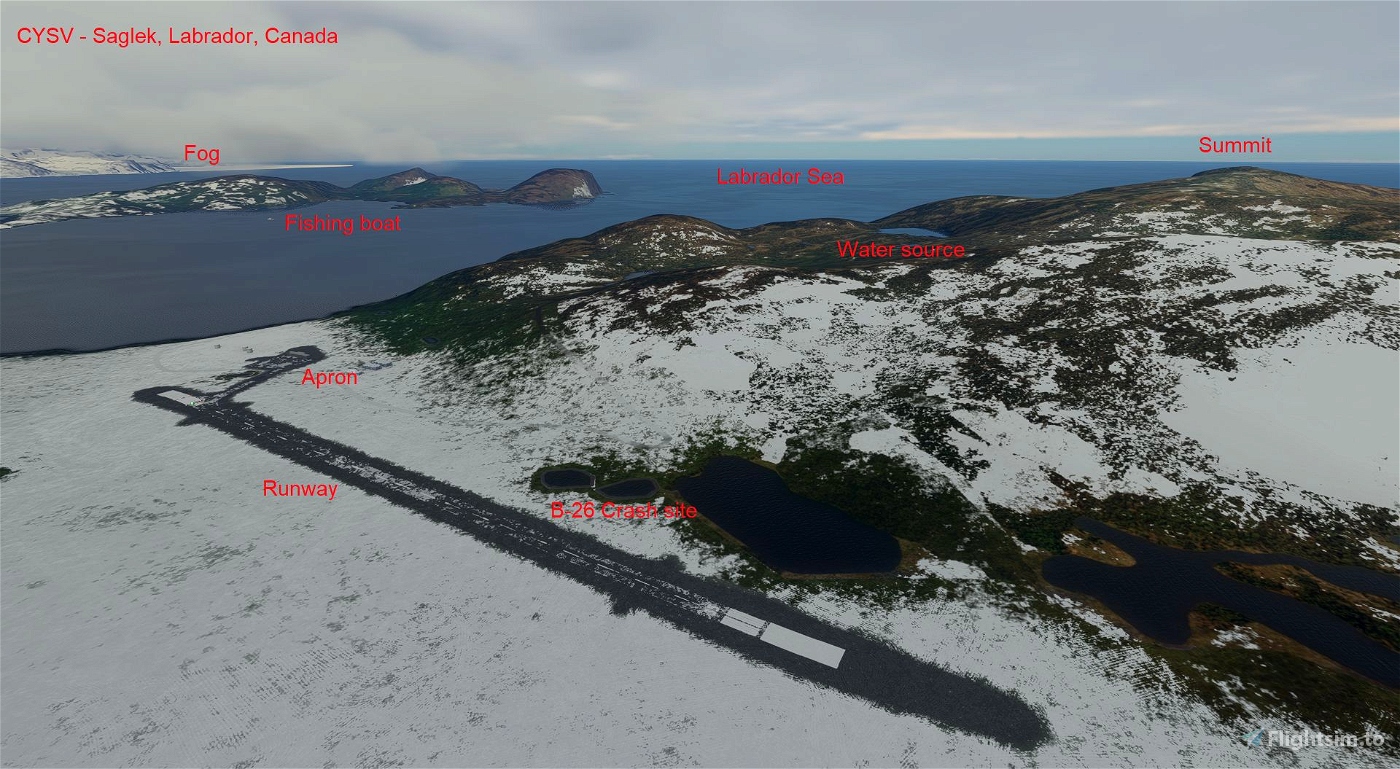
This airstrip gives another location for those needing a landing point while flying the North Atlantic crossing either to or from Greenland, or on the way to or from Baffin Island. It is rare for this area in that the airstrip is paved and has markings on it to this day. Be careful due to the high terrain surrounding the airstrip.
In the default scenery, Saglek airstrip is missing, represented by a grass texture and not a paved airstrip. This scenery adds the abandoned Saglek airstrip using information from the Canadian Flight Supplement (expired editions), the internet and personal memory. Only default MSFS SDK scenery elements are used.
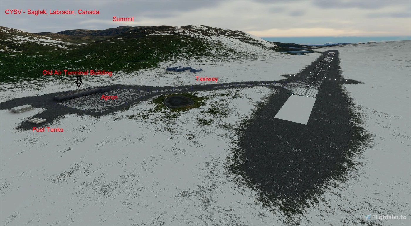
Scenery includes:
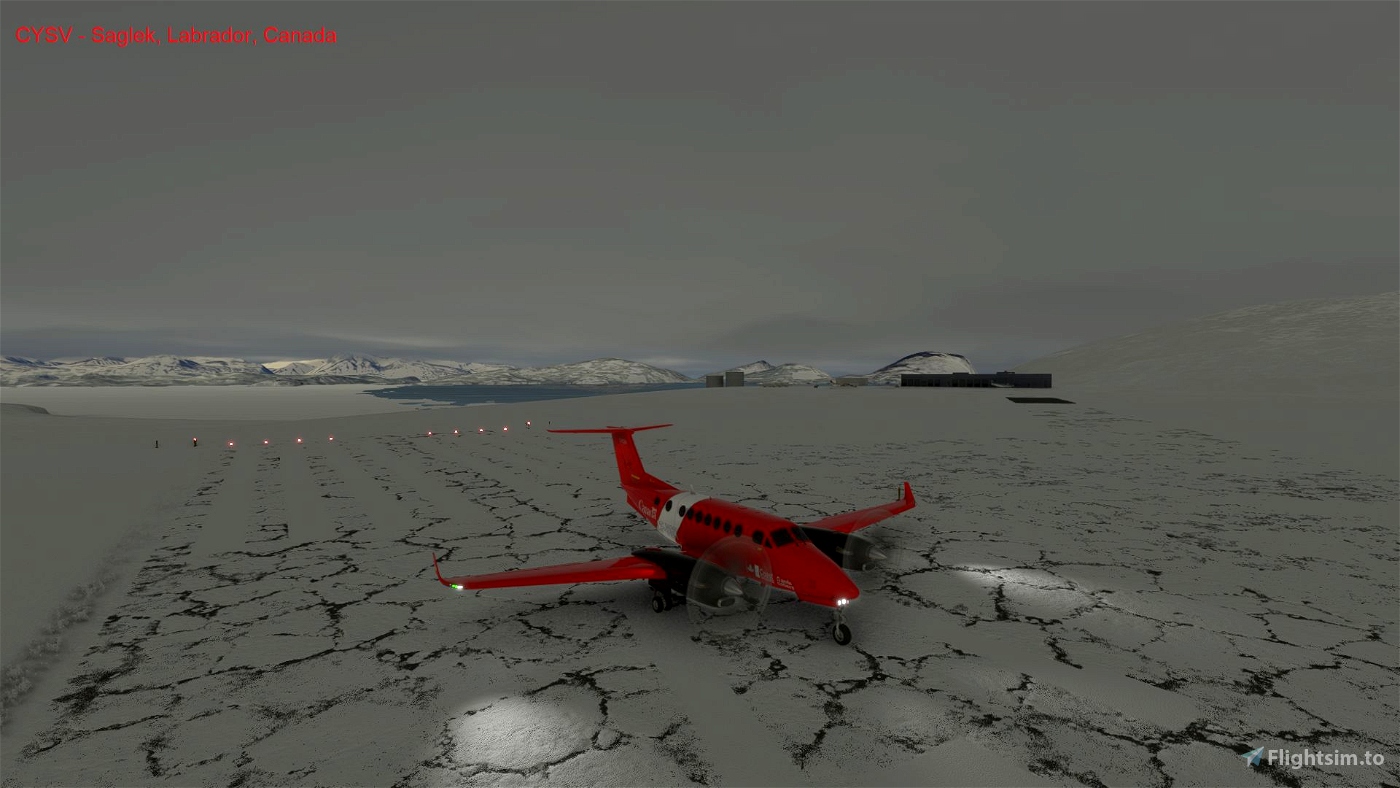
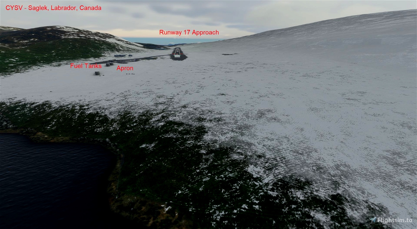
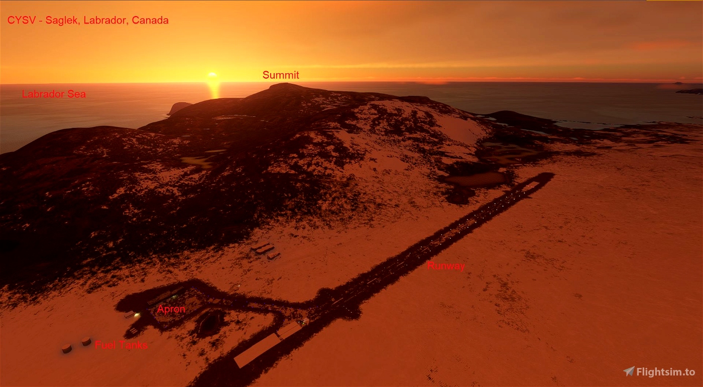
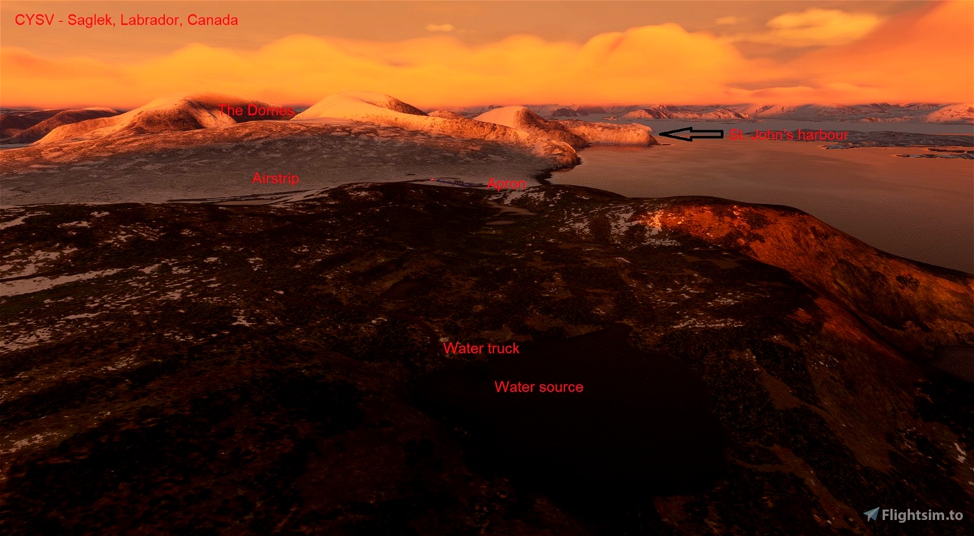
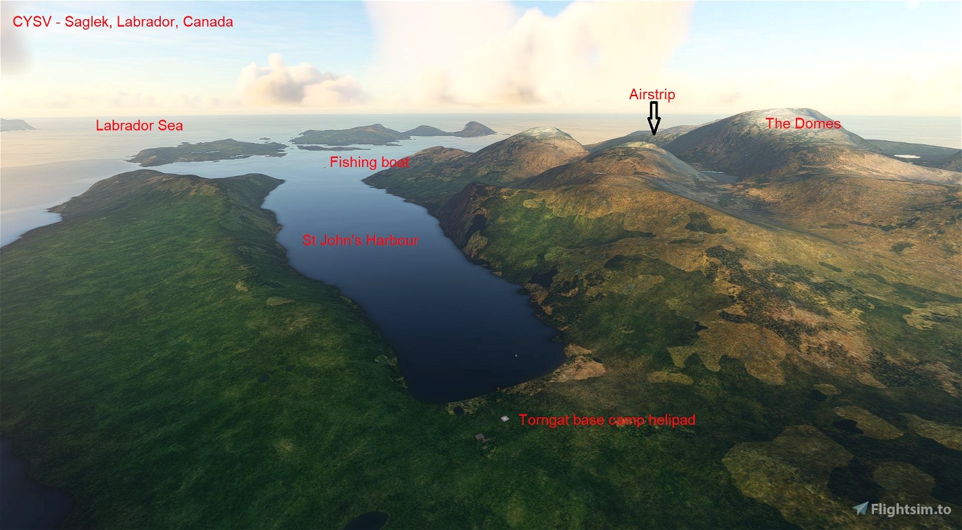
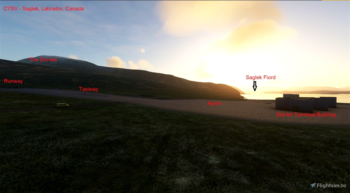
* 4750 x 150 feet paved airstrip at 269 feet elevation
- Runway end identification lights
- Windsocks at each end of the runway
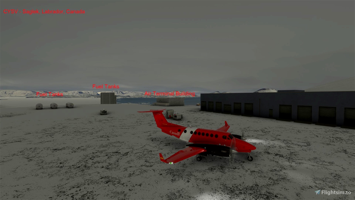
- Apron and limited lighting
- Refueler
- Air terminal building
- taxi lighting
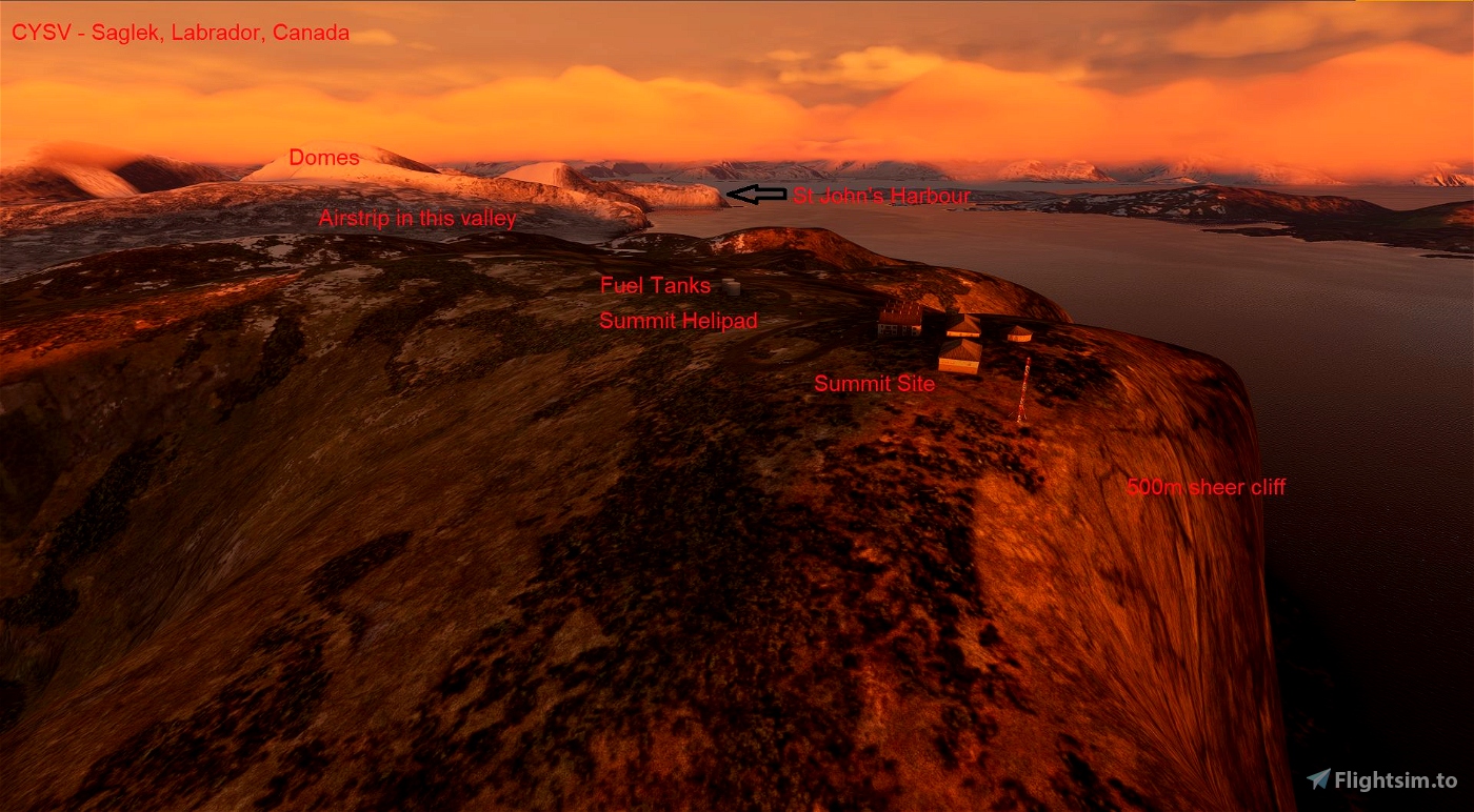
* Summit helipad.
* Antenna.
* Fuel tanks.
* Vehicles at various locations on the roads around the area.
* Torngat Mountains base camp helipad on St. John's harbour.
* Boats in St John's Harbour.
* Fishing Vessels north and west of the airstrip.
* Removal of some trees from the area. (There are no trees along this part of the Labrador coast in reality).
Improvements to come:
* Add more shipping in the area.
* Replacing summit buildings with more appropriate structures.
* Changing textures to better represent the sparse vegetation and rocky nature of the area.
* Removal of more trees on the surround landscape.
* Addition of Points of Interest (POIs) identifying nearby features.
* Addition of Hebron abandoned community south of Saglek.
Location details of the airstrip:
* ICAO: CYSV
* IATA: YSV
* Airstrip location: 58-28-28 N, 62-39-15 W (58.474444, -62.654166)
Saglek is located approximately:
* 4.6 km west of summit site.
* 8.4 km east of St John's Harbour Torngat Mountains Base Camp.
* 31 km north of Hebron abandoned Mission site, Labrador. Canada.
* 222 km north of Nain airstrip, Labrador, Canada.
* 339 km east of Kuujjuaq airport, Quebec, Canada.
* 590 km north of Happy Valley-Goose Bay airport, Labrador, Canada.
* 665 km southeast of Iqaluit airport, Nunavut, Canada.
* 1005 km west of Narsarsuaq airport, Greenland.
History:
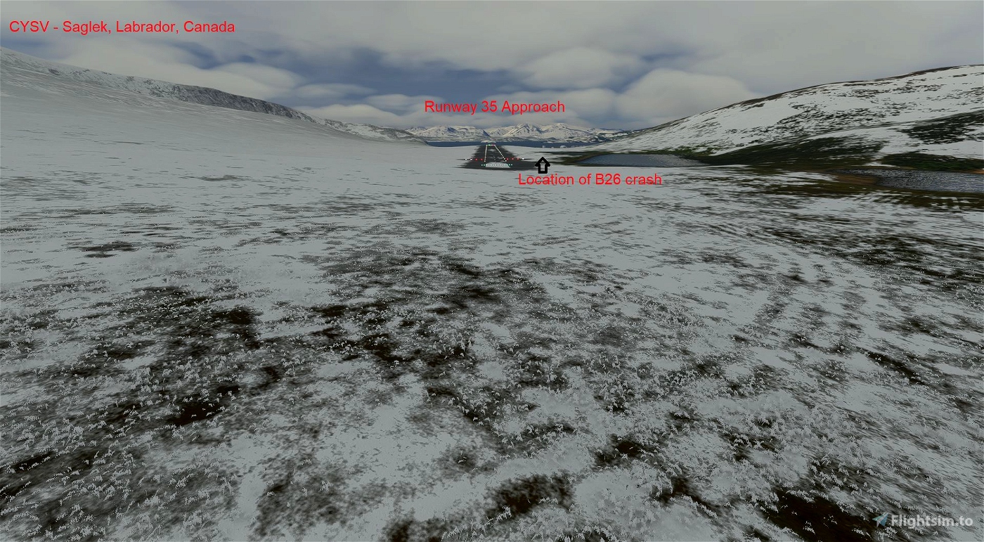
Saglek is located on the northern Labrador coast. It was the site of a Martin B-26 Marauder from 440 Sqn, 319 Bomb Group (Times a Wastin') plane crash on December 10, 1942. All 7 crew survived but would all succumb to the conditions over the next few months (see the links below for the diary of the captain. This was before any of the facilities were built. In 1953, Canadian Forces Station (CFS) Saglek was created with a radar site (known as N29) built in support of the Pinetree Line early warning radar line, run by the 924th Aircraft Control and Warning Squadron of the United States Air Force in conjunction with the Royal Canadian Air Force. This site was closed in 1970. In 1989, the site became a radar site again for a North Warning System (NWS) Long Range radar site that is currently active. Currently, the Torngats National Park is Saglek's immediate neighbour.
Installation:
Place the folder in your community folder and enjoy - the airstrip is starred and located off the eastern coast of Baffin Island
I hope you enjoy the updated area!
ARH64CDN - contact on www.flightsimulator.com
April 2021

 ARH64CDN


IanBrettCooper
Thanks for this scenery. I wasn't sure if I would use it on my around the world trip in my Grumman Goose, but as it turns out, the winds forced me to relocate from Makkovik farther north to get across the Labrador Sea, so I ended up here. And once I got here, I was so happy to see the polar bears! Thanks for that little detail!
Thanks for including the story about the Marauder. Have you considered adding the remaining wreckage at the POI (the wings are still visible on Google Maps) as a monument to those men?
ARH64CDN author
Wow, nice to hear someone using the scenery AND reading the story. Placing the wrecked aircraft beside the runway is still beyond my skill level. I have been there in person 26 years ago and really only the wings were left at that time. It was strange to see wreckage beside the runway that actually predated the runway by decades! Curious, are you documenting your around the world flight in the Goose?
PS. There were polar bears there on my visit 26 years ago!
1 years ago
todorokipm
Prämie
ARH64CDN
Prämie author
3 years ago