


frisian islands sand banks
----------------------------------
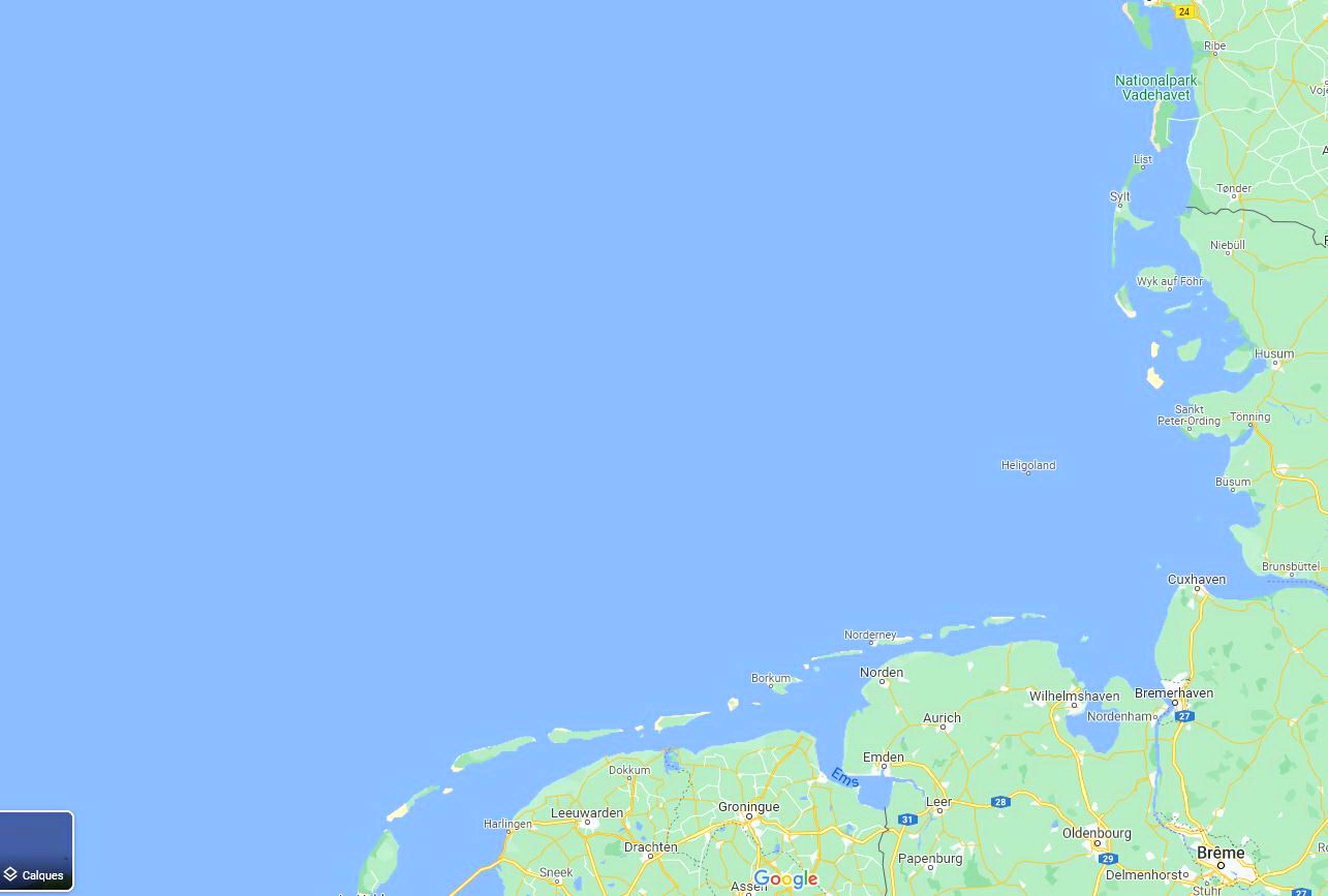
The Frisian Islands, also known as the Wadden Islands or the Wadden Sea Islands, form an archipelago at the eastern edge of the North Sea in northwestern Europe, stretching from the northwest of the Netherlands through Germany to the west of Denmark. The islands shield the mudflat region of the Wadden Sea (large parts of which fall dry during low tide) from the North Sea.
The Frisian Islands, along with the mainland coast in the German Bight, form the region of Frisia (German and Dutch: Friesland), homeland of the Frisian people. Generally, the term Frisian Islands is used for the islands where Frisian is spoken and the population is ethnically Frisian. In contrast, the term Wadden Islands applies to the entire archipelago, including the Dutch-speaking westernmost islands of Texel and Vlieland and Danish-speaking Danish Wadden Sea Islands further north off the west coast of Jutland.
Most of the Frisian Islands are environmentally protected areas, and an international wildlife nature reserve is being coordinated between the Netherlands, Germany and Denmark. Natural gas and oil drilling continue, however, and in the vicinity of the Ems, Weser and Elbe estuaries, and ship traffic causes tension between wildlife protection and economic values.
GPS : 53.547462, 6.269623
v1.0
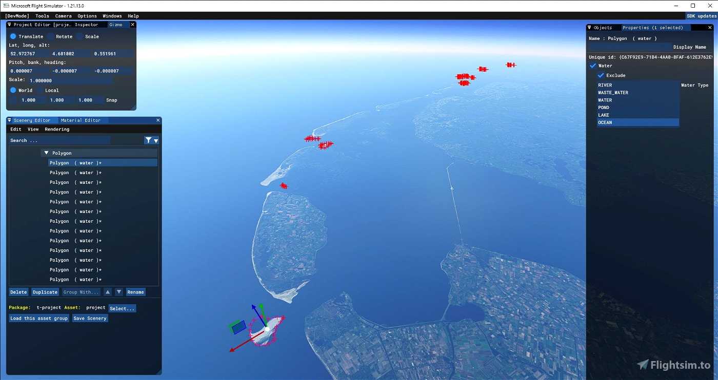
1..add all major sand banks and sand islands (more than 30) along Frisian islands
v1.1
1..remove all vegetation over sand banks
v1.2
1..fixed polygons edges issues
v1.3
fix water polygon issue from last update

 timot75


7 months ago
barendbluf
Doesnt seem to work anymore 😞 first thing i noticed is that Noorderhaaks is missing between Den Helder and Texel, but its featured in 2 of your screenshots here, also i do not see any change for Richel and Griend with or with out the mod... Could be V1.2 is missing files.
Sub Folder Scenery only has a poly.bgl file, and the main folder only layout and manifest, is this correct? if not could you upload a fixed version?
1 years ago
thanks for reporting
I will check that as soon as possible
1 years ago
timot75
PatrickC76
Thanks for this mod, love the Waddenzee! One small remark: mostly south of Ameland there are some artificial looking ground textures in roughly rectangular-ish shapes. Are they a bug?
2 years ago
mdamstel
Is there a conflict between this mod and this mod: https://flightsim.to/file/25954/east-frisian-islands-sandbanks
?
2 years ago
THEOLI4D
I figured I'd rate this mod too, as I think it deserves more than the three stars that someone else gave it so far. Five stars might be a bit excessive, compared to some huge and really excellent add-ons that can be found here on flightsim.to as well, but it sure is a valuable addition to bring the Wadden Sea to life.
2 years ago
ZuluBravo
Great addition, thanks! I am a sailor myself and lived on Texel for a while, so I have sailed the (Dutch) Wadden Sea a lot. Hence I found it a bit of a pity that most sand banks were missing. Griend was there, and the Bornrif, but Richel, which is so consipuous opposite the entrance of Vlieland harbour IRL, was missing, as well as "De Razende Bol"/Noorderhaaks, which I visited several times with my boat. So I really appreciate that you added these!
Do you think it would be possible to smoothen Richel a bit though: right now it has rather sharp corners and straight line, which makes it pretty obviously fake. If you could give it a bit more rounded corners, it would look significantly better.
2 years ago
hello
Richel sharp corners and straight line are not because of my scenery
they were already there with the default scenery
just remove my scenery from community folder, and check it
I think it is a water issue from bing data
maybe you can send me a screenshot to show me what you think is wrong
best regards
2 years ago
timot75
ZuluBravo
Thank's. Great work!
2 years ago
Rover737
Thanks for V 1.1 Without the trees!
2 years ago
hansb57
Big improvement, well done, but please remove trees from the sandbanks.....
2 years ago
hello
that is it
vegetation has been removed
enjoy
2 years ago
timot75
crazycloudclimb
Hee, thank you very much, Timot75!
An additional idear: some seagull's above the sandbanks...
2 years ago
Haha, or even better still: seals...
2 years ago
ZuluBravo
bstikkel
Thanks for this mod. Although I think there are no trees on the sandbanks
2 years ago
hello
thanks for reporting
I though some could have minor vegetation
I will fix that
2 years ago
timot75
hansb57
Hi. Thank you for that. Is it compatible with Frisische Inseln by Aerosoft?
2 years ago
hello
it should be, but I can't be sure as I don't have the scenery by aerosoft
2 years ago
timot75
Archer374
Thank you for this mod. I hoped that the France&BeNeLux would take care about Frisian islands, especially about they watermasks. I think some people forget that big areas of shallow water and long sandy shores are not just a thing of the Caribbean islands. Nice to see someone is finally improving them.
2 years ago
Maxest