
French Alps - Department of Savoie (73) 1.0.0
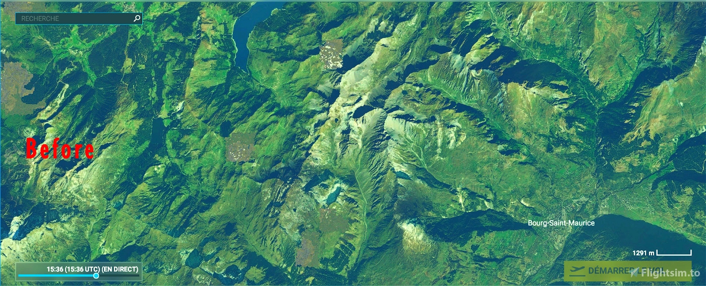
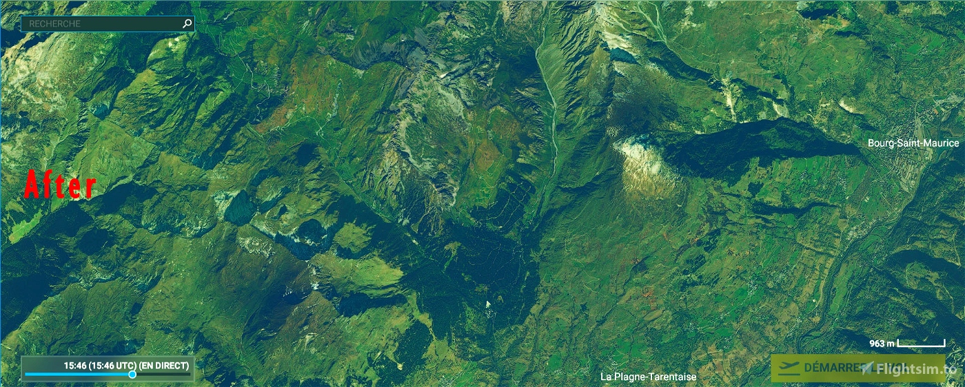
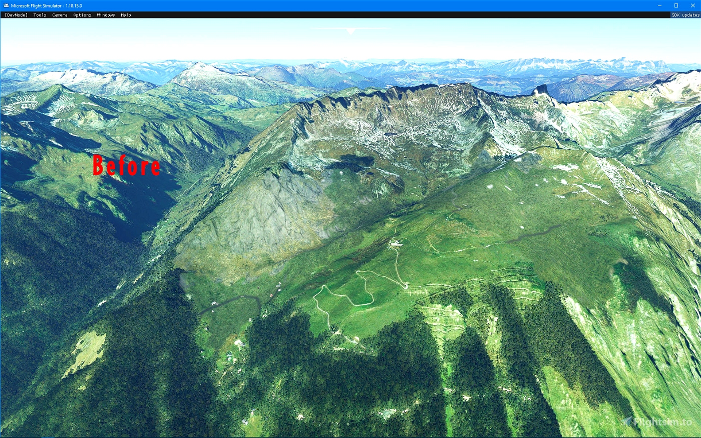
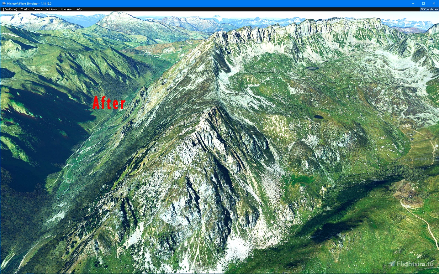
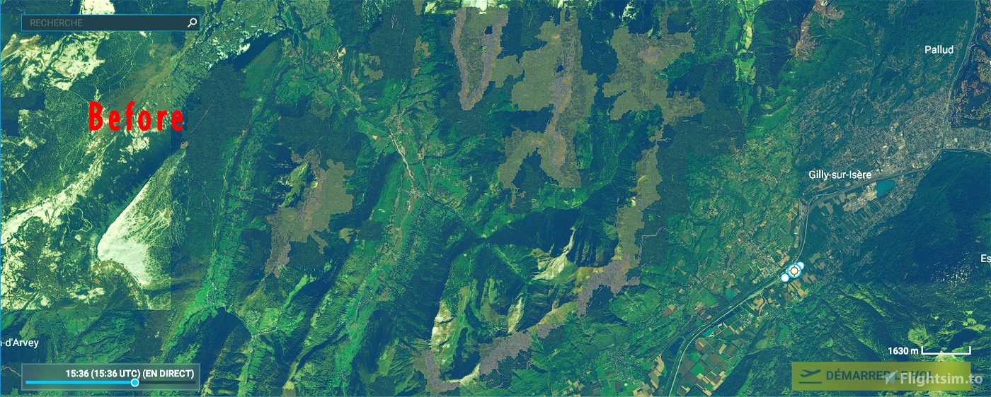
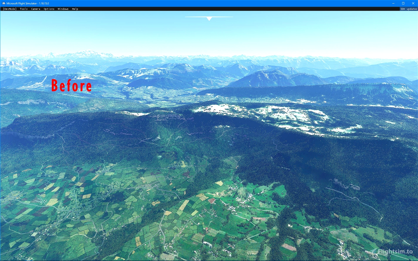
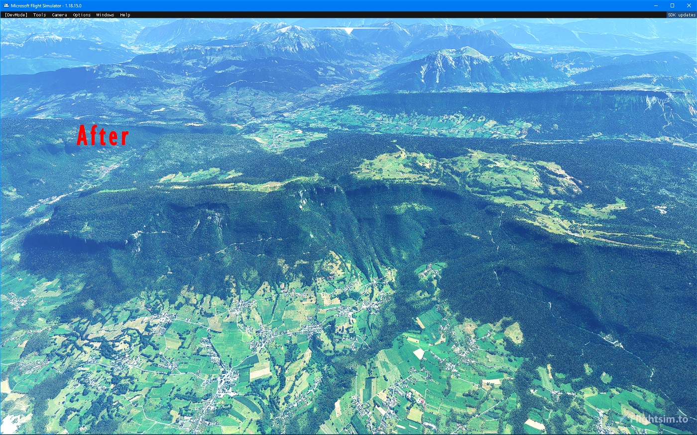
Since MSFS BingMap imagery is of poor quality, or even replaced by generic textures on some mountain ranges in the Savoie department (73), this supplement, produced with the source of the BD ORTHO® OpenData aerial photographs from IGN, makes it possible to correct this problem very advantageously. The resolution is 2.39 m (Lod16) around Chambéry and 1.29 m (Lod17) around Bourg-Saint-Maurice.
Installation: extract then copy and paste in your "Community" directory
Thanks to:
Microsoft
Asobo
MSFS Toolkit by Nool Aerosystems
Copyright: ftsxlw
[email protected]
Exclusively for free distribution and subject to the express authorization of the author.
Alpes Française - Département de Savoie (73) 1.0.0
L'imagerie BingMap de MSFS étant de mauvaise qualité, voire remplacé par des textures génériques sur quelques massifs montagneux du département de la Savoie (73), ce complément, réalisé avec la source des photographies aériennes BD ORTHO® OpenData de l'IGN permet de corriger très avantageusement ce problème. La résolution est de 2.39 m (Lod16) sur les alentours de Chambéry et de 1.29 m (Lod17) aux alentours de Bourg-Saint-Maurice.
https://fr.wikipedia.org/wiki/Savoie_(d%C3%A9partement)
Installation : extraire puis copier-coller dans votre répertoire « Community »
Merci à:
Microsoft
Asobo
MSFS Toolkit by Nool Aerosystems
Copyright : ftsxlw
[email protected]
Exclusivement pour diffusion gratuite et soumise à autorisation expresse de l’auteur.

 ftsxfreelw


9 months ago
Dcibarnaby
Hello,
Thank you very much for your work.
But it seems to not working in VR mode. True?
2 years ago
2 years ago
ftsxfreelw
bebel
it is necessary to copy the 3 files?
3 years ago
Yes of course !
3 years ago
ftsxfreelw
pop21