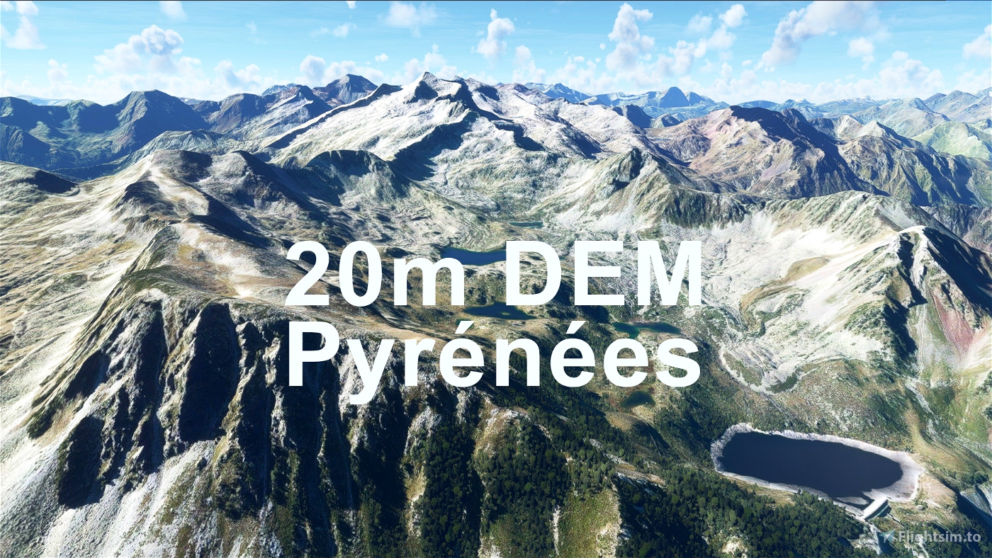
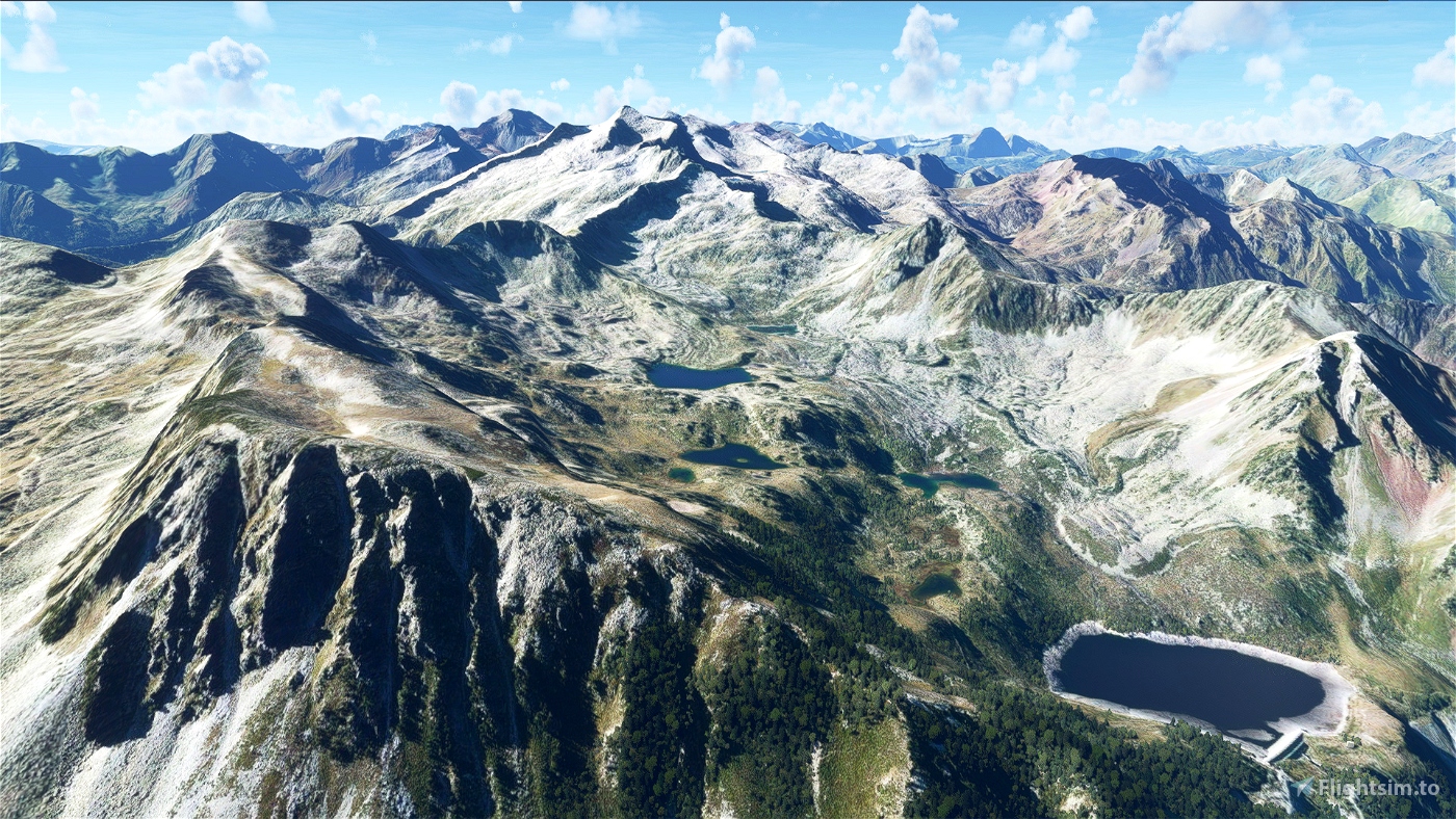
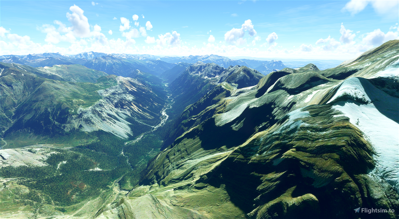
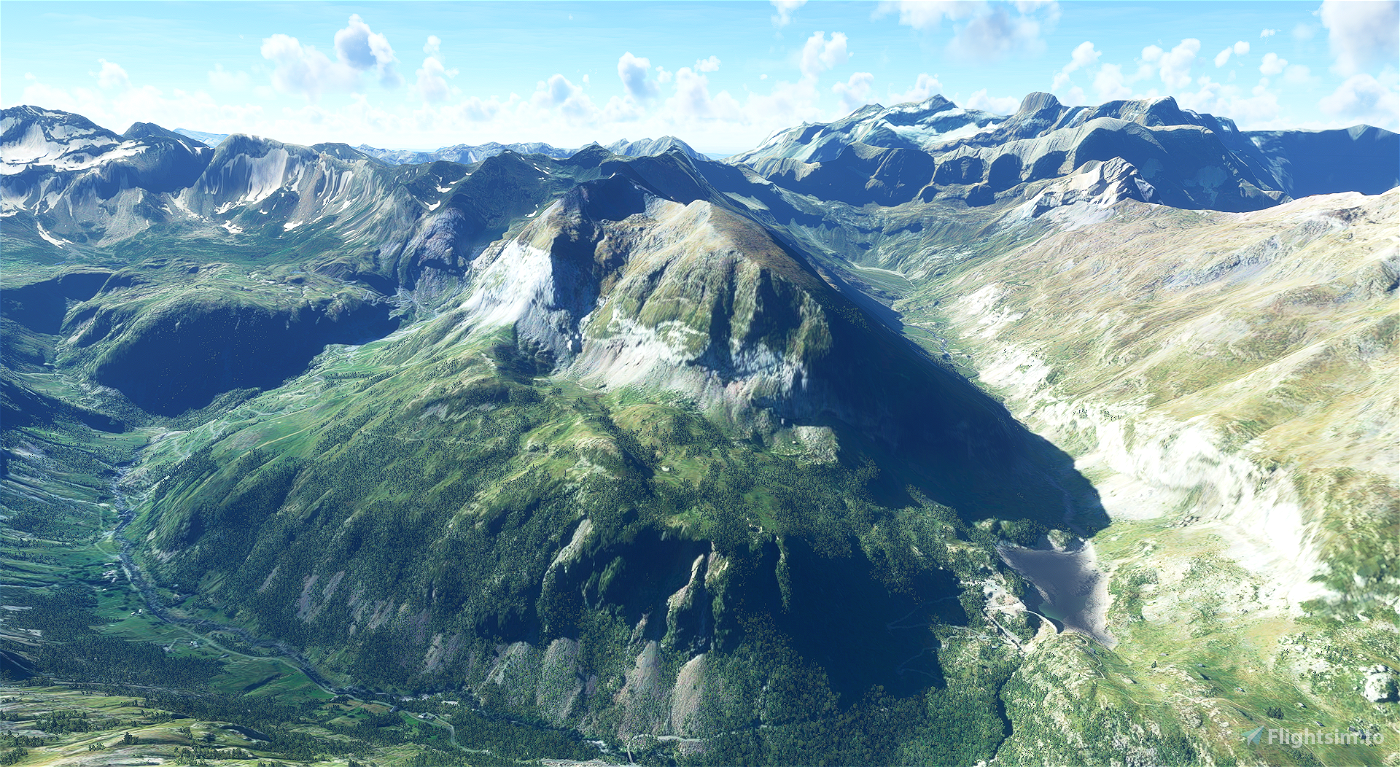
Experience the Pyrénées!
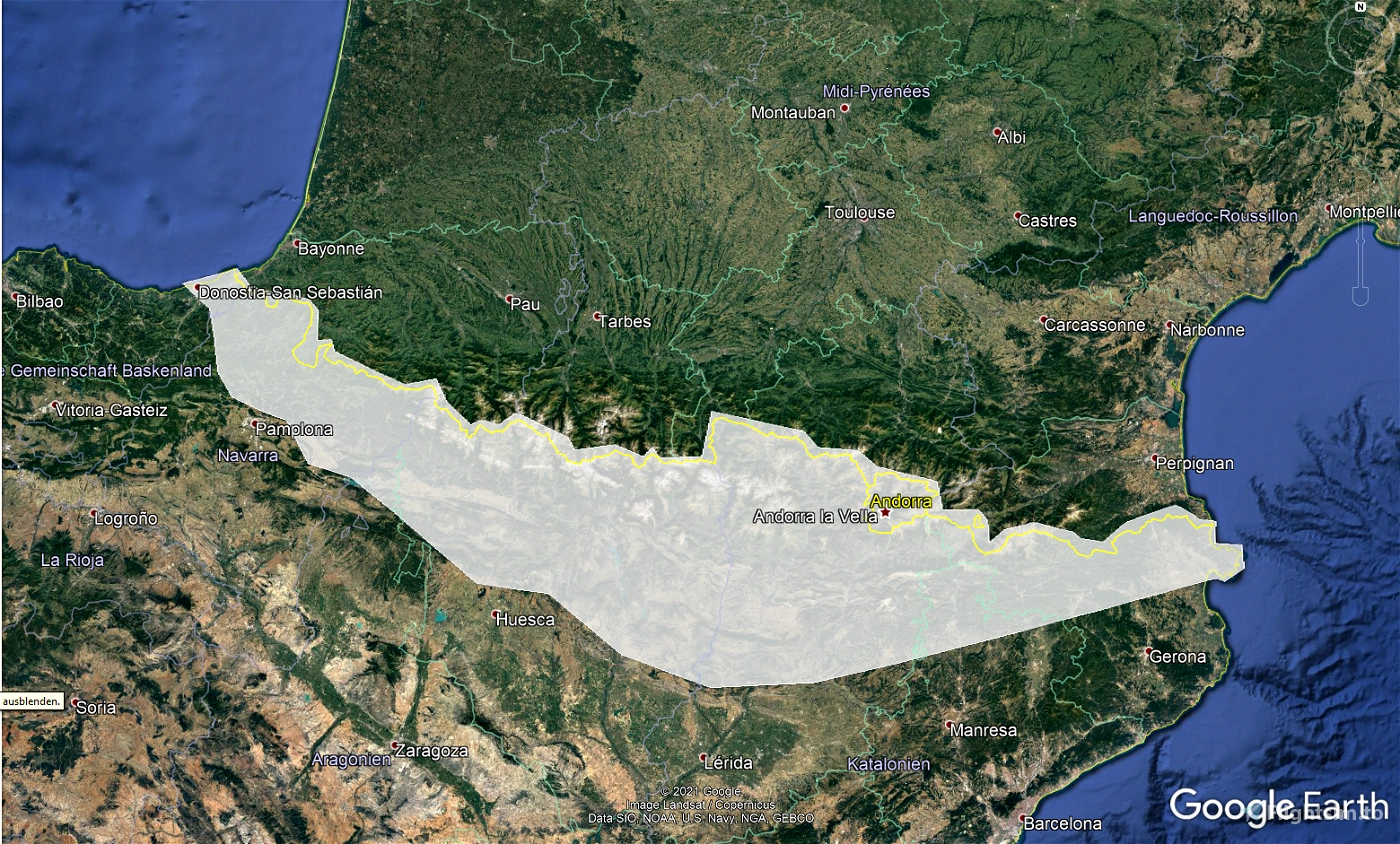
This mod contains customized height profiles for the Pyrenees mountain range. The affected area contains Spanish and Andorran territory. The French part has been removed from the package due to the generic mesh being as good or better than the mod.
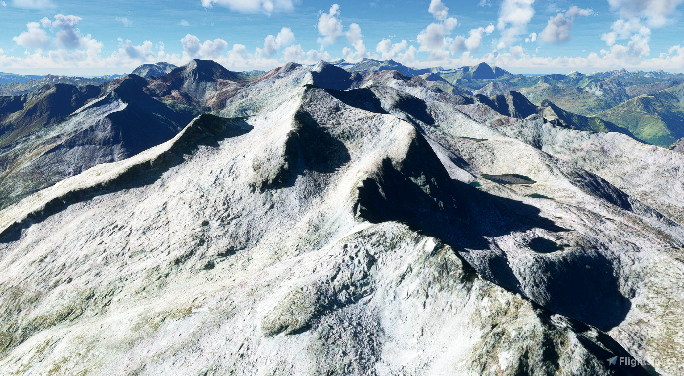
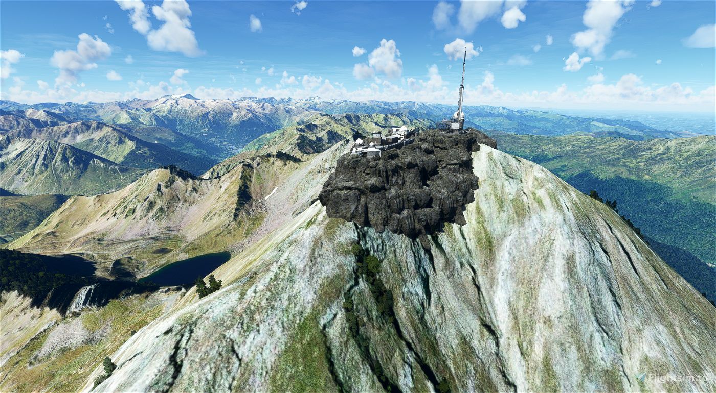
The mod contains high definition LIDAR DEM data with a mesh resolution of 20m. The height resolution is as good as 0.1m.
The mod does not only provide mountain shapes being very close to reality, but also flattens lakes & rivers and gets rid of any terrain artifacts.
IMPORTANT
Not sure why flightsim is naming the downloads so strangely, here is the deal:
- Main file: Pyrenees of Spain/Andorra
- Secondary file: Pyrenees of Spain/Andorra/France
Disclaimer: The creator of this mod is not responsible for any problems, damage, incompatibilites to other mods or performance issues that might occur.
Please note, that this mod is a very high resolution mesh covering the whole of Switzerland. The elevation data is applied through terraforming rectangles, thus loaded at a certain distance from the player. When travelling fast or at high alitude (wide range of view) there might be too many new rectangles loaded simultaneously and thus stutters might occur.
If you have any stutters you can try and reduce your ingame render settings or uninstall!
If you are mainly flying airliners in high altitude, there is probably no benefit for you in using this mod.
Affected Sceneries
As it stands none are known!
Please report any bugs with sceneries or airports and I will see what I can do!
Installation
Simply unzip the downloaded folders and copy them into your community folder!
Credits
The elevation data used was a LIDAR 20m height profile of Spain, Andorra compiled by Sonny (https://data.opendataportal.at/dataset/dtm-spain/resource/38816df0-9d50-476f-832e-0f7f5fa21771)
It was then transfered into MSFS using MSFS Toolkit by Nool Aerosystems (https://msfs.nool.ee/)
Thank you both and for anyone reading this: Please go ahead and support them!
Enjoy your VFR flights above the Pyrenees!

 Troglodytus


amazing!!! thank you!!
3 years ago
thank you! Glad you like it!
3 years ago
Troglodytus
TETSUO
Thank you very much for your time and work.
3 years ago
EullinLivery
Vielen Dank für ihre Arbeit.
Beim Flugplatz LECD (La Cerdanya) gibt es ein Problem. Die Start-/Landebahn ist auf zwei verschiedenen Höhen. Wenn ich ihr Mesh deaktiviere, ist alles o.k.
Können sie das korrigieren?
Freundliche Grüsse
PS. Entschuldigung, habe soeben festgestellt, dass dieses Problem schon vor einiger Zeit durch John_Fields gemeldet wurde.
3 years ago
I can confirm that the threshold area of Runway 07 at LECD has a strange step in it when running this mesh. Other than that, it is fantastic.
3 years ago
ZXMaster
KHKH
Could you make the Himalayan mountains.
3 years ago
c17
Hi! I haven't been in the Pyrenees before, but it looks awesome! Thank you!
3 years ago
Scotty
I am a lost 😊
You wrote :
1.1 (main file) contains the spanish/andorran area of the pyrenees.
1.2 (secondary file) contains all parts (french/spanish/andorran)
But Main file is 1.2 now (despite when downloading it is named 1.1 version...)
So there are actually two files available 1.2 (1.1 ?) and 1.0
I think the actual main 1.2 224 Mo file is the "right last version" (i.e. last version without French part ). Is it right ?
By the way many thanks for your amazing work on this area and many other ones
3 years ago
Thank you for your comment. I am very sorry about this mess, It's crazy, that flightsim does not let you rename the files and their versions as you please... its actually simple:
Main File: Spain/Andorra
Secondary File: Spain/Andorry/France
..thus the bigger file size on the secondary download, because its the larger region.
Dont let the versions confuse you please.
3 years ago
Troglodytus
Lucky
hi, in the 1.1 version LESU still has bumps on the runway and buildings floating. it is confusing which version i have to download and place in the comunity folder to have this aiport correct
3 years ago
Can you try to download & install it again? I excluded LESU La Seu d'Urgell, so not sure what is going on!
3 years ago
Troglodytus
miguel370
the link v1.2 gives a file named 1.1
3 years ago
yeah, its a mess. flightsim does not let me name the downloads as I want to, they still show some old versions and I don't know why.
Basically: Main file: Spain/Andorra
Secondary file: Spain/Andorra/France
I have updated the description as well now.
3 years ago
Troglodytus
JLD95
There are two files 1.1 and 1.2, do I download both, or just 1.1 as a main file?
3 years ago
thank you for your comment. I should specify a little more in the description, perhaps.
1.1 (main file) contains the spanish/andorran area of the pyrenees.
1.2 (secondary file) contains all parts (french/spanish/andorran).
Some users reported this mod giving no upgrade to the french parts, so I made an additional file available without the french territories.
3 years ago
Troglodytus
THartmann9374
I think the update 4 in france use differents dem but i am not sure of that. I think dem of Alps (Mont Blanc for exemple in very very good -dem 10??) is a better dem than the dem of pyrénées of the same update 4 (i don't think is over 20 m). i will be curious to know advice of Asabo.
With new test, i confirm what i think...The dem Pyrénées version 1.0 with french Part is better on some peaks in country of Aneto, Vignemale, and Balaittous. But i don't say that for all the dem but i love ths Dem Pyrénnées version 1.0....i wait the exclude in come...Thanks you for that!!
If, after test, only have different opinion with some coutry of dem, say me, i would like test too for to see that...Good play!!
3 years ago
benson09
continuing with the investigation I have found a web where it comes where we can get the DEM of 30 meters of any part of the world, the limit to generate it is 450,000 km2.
you choose a range of any part of the world and wait until it processes it.
https://portal.opentopography.org/raster?opentopoID=OTSDEM.032021.4326.3
could be useful to us? Could it be a better resolution than the one we already have in the simulator?
3 years ago
Thank you very much for your comments. So just to sum up the current situation after many many hours of experiments with different meshes:
It seems like there most countries I have flown to have a generic mesh of about 30m anyways. Sometimes it appears to be worse at about 50m (just a guess).
Countries that have received world updates are way better though. For example France seems to have received a mesh of about 5-10m when comparing to my experiments.
Further stating: Although it would be possible in theory to have high detailed meshes all around, I have to say that 20m seems to be the maximum I can make for larger areas while maintaining useful filesizes. 10m for smaller countries or areas and i can make individual mountains in higher quality. This seems to be the limitations of reasons.
To sum up: It seems that currently about 20m is an update for many areas due to their low res base mesh. If you have any specific request for a mountain or mountain group I can try and make it highly detailed. However, something like 25cm for Wales would not be feasible.
At least Currently! Maybe implementation of DirectX12 will change things within the sim.
Regarding data: The awesome msfs toolkit needs geotiff data. Ideally it is a DEM or DTM as the DSM also contains structures and vegetation and would be off.
Thank you :)
3 years ago
Troglodytus
daavids19
Hi guys, doing some research to help you and look for more lidar data I found the country of Wales with lidar data up to 25 cm and many other resolutions I pass you the link, covers the whole country, even though it is also specified for each discharge which area of the country is covered, but it is very complete.
If you want I continue investigating more countries, but it is difficult to find free download data.
http://lle.gov.wales/GridProducts#data=LidarCompositeDataset
Im from spain it is not my country
and I have a question, which is better DEM, DSM or DTM? are they all compatible with what we can pass to fligth simulator? looking for information I think the most complete is the DSM because it has more data, rivers etc
3 years ago
daavids19
Thank you very much for all your hard work and all of these mods! The best part is that it's free, you're awesome.
3 years ago
Thank you for your comment and you are welcome :)
As we have seen in the past days the greed in certain aircraft developers can take over and I want to avoid similar things from happening. Thus why I want to provide experience enhancements in the form of my mods for free :)
3 years ago
Troglodytus
Camargo24
Hello Troglodytus, i tried version 1.1 and, for me, there is a problem between your Spain's dem and dem french (unreal peak or profile breking mountain...) For exemple, a French country i know very well in Couserans (Ariège) at south od Saint-girons, Fly from altiport free addon, airport-lf0921-altisurface-d-aleu, South between the CITY of SEIX and AULUS, peak Pte Rabassere et Montabonne, where there is ponds of hillette and Alet... But the Visuel is excellent with version 1.0. I don't know what's the matter with this conflict, but i prefer the version 1.0 with good french visuel (as update 4) and excellent Spain visuel. I am happy with the 1.0 but i think you want to know this problem with a country i know very well...It's possible there is other more....I go test other country in French Pyrennées later. Thank you to give more choice of dem and versions for the community. Great Job !
3 years ago
Thank you so much for your feedback. I had a brief flight to check after recompiling v1.1 and did not experience strange mountain shapes. I am no local and don't know the area in reality though.
Very sorry if you experience if the experience was not as great as expected.
At least you can stick with the old version for now.
I am planning to release an update for v1.0 (french area included) with excluded payware airports as well.
3 years ago
Troglodytus
benson09
Thanks for the work. To be complete, can I ask you to do also the Asturias mountain west part of Pyrenea with The Pico of Europa ? thanks in advance
3 years ago
Sorry I think the Cordillera Cantábrica are a different mountain range and not part of the Pyrenees!? Maybe I will release a separate addon.
3 years ago
Troglodytus
todorokipm